Date Published
March 30, 2015
Document Category
Summary
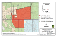
Maps of Southeast Arizona Land Exchange and Conservation Act of 2011 including Federal Parcel, Oak Flat, Apache Leap, Cave Creek, East Clear Creek, Tangle Creek, Turkey Creek, Lower San Pedro River, Dripping Springs, Appleton Ranch, Superior Airport, and Fairview Cemetery.


