Documents Cited - General Plan of Operations
|
Contrasts Between Short- and Long-Term Records of Seismicity in the Rio Grande Rift – Important Implications for Seismic Hazard Assessments in Areas of Slow Extension | Machette, M.N., 1998, Contrasts between short- and long-term records of seismicity in the Rio Grande rift – Important implications for seismic hazard assessments in areas of slow extension, in W.R. Lund (ed.), Western States Seismic Policy Council Proceedings Volume, Basin and Range Province Seismic Hazards Summit, Utah Geological Survey Miscellaneous Publication 98-2, p. 84-95. Download PDF |
|
Synclinal-Horst Basins: Examples From the Southern Rio Grande Rift and Southern Transition Zone of Southwestern New Mexico, USA | Mack, G.H., Seager, W.R., and Leeder, M.R., 2003, Synclinal-horst basins: examples from the southern Rio Grande rift and southern transition zone of southwestern New Mexico: Basin Research, v. 15, p. 365-377. Download PDF |
|
Principles of Geochemistry | Mason, B. and Moore, C.B. 1982. Principles of Geochemistry, John Wiley & Sons, New York. Download PDF |
|
Earthquake Site Conditions in the Wasatch Front Urban Corridor, Utah | McDonald, G.N. and Ashland, F.X., 2008, Earthquake site conditions in the Wasatch Front urban corridor, Utah: Utah Geological Special Study 125, 41 p., 1 plate, scale 1:150,000. Download PDF |
|
Technical Basis for Revision of Regulatory Guidance on Design Ground Motions: Hazard- and Risk-Consistent Ground Motion Spectra Guidelines | McGuire, R.K., Silva, W.J., and Costantino, C.J., 2001, Technical basis for revision of regulatory guidance on design ground motions: Hazard- and risk-consistent ground motion spectra guidelines: U.S. Nuclear Regulatory Commission NUREG/CR-6728. Download PDF |
|
Technical Basis for Revision of Regulatory Guidance on Design Ground Motions: Development of Hazard- and Risk-consistent Seismic Spectra for Two Sites | McGuire, R.K., Silva, W.J., and Costantino, C.J., 2002, Technical basis for revision of regulatory Guidance on design ground motions, report prepared for U.S. Nuclear Regulatory Commission. Download PDF |
|
An Animated Tectonic Reconstruction of Southwestern North America Since 36 Ma | McQuarrie, N., and Wernicke, B.P., 2005, An animated tectonic reconstruction of southwestern North America since 36 Ma: Geosphere, v. 1, p. 147–172. Download PDF |
|
Evidence for the Latest-Miocene to Pliocene Transition from Basin-Range Tectonic to Post-Tectonic Landscape Evolution in Southeastern Arizona | Menges, C.M. and McFadden, L.D., 1981, Evidence for the latest-Miocene to Pliocene transition from Basin-Range tectonic to post-tectonic landscape evolution in southeastern Arizona: Arizona Geological Society Digest, v. 13, p. 151-160. Download PDF |
|
Map of Neotectonic (Latest Pliocene-Quarternary) Deformation in Arizona | Menges, C.M. and Pearthree, P.A., 1983, Map of neotectonic (latest Pliocene-Quaternary) deformation in Arizona: Arizona Bureau of Geology Mineral Technology Open-File Report 83-22, 48 p., scale 1:500,000. Download PDF |
|
Late Cenozoic Tectonism in Arizona and its Impact on Regional Landscape Evolution | Menges, C.M. and Pearthree, P.A., 1989, Late Cenozoic tectonism in Arizona and its impact on regional landscape evolution: in Geologic Evolution of Arizona, Arizona Geological Society, Digest No. 17, p. 649–680. Download PDF |
|
Earthquake Recurrence Intervals and Plate Tectonics | Molnar, P., 1979, Earthquake recurrence intervals and plate tectonics: Bulletin of the Seismological Society of America, v. 69, p. 115-133. Download PDF |
|
Interim Results of Groundwater Monitoring: Upper Queen Creek and Devils Canyon Watersheds, Resolution Copper Mining LLC, Pinal County, Arizona | Montgomery & Associates. 2010. Interim Results of Groundwater Monitoring, Upper Queen Creek and Devils Canyon Watersheds, Resolution Copper Mining LLC, Pinal County, Arizona: Final report prepared for Resolution Copper Mining LLC, February 17, 2010. Download PDF |
|
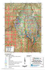
Apache Leap Tuff Water Level Contours Upper Queen Creek/Devils Canyon Study Area (Map) | Montgomery & Associates. 2011. Apache Leap Tuff Water Level Contours Upper Queen Creek/Devils Canyon Study Area (Map). March 1, 2011. Download PDF |
|
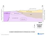
Schematic Representation of Hydrogeologic Systems (Figure) | Montgomery & Associates. 2012b. Schematic Representation of Hydrogeologic Systems (Figure). February 2012. Download PDF |
|
Results of Phase II Hydrogeologic Investigations in Support of Tailings Prefeasibility Study, Far West Site | Montgomery & Associates. 2012c. Results of Phase II Hydrogeologic Investigations in Support of Tailings Prefeasibility Study, Far West Site. July 31, 2012. Download PDF |
|
Results of Queen Creek Corridor Survey: Superior Basin, Pinal County, Arizona | Montgomery & Associates. 2013a. Results of Queen Creek Corridor Survey Superior Basin, Pinal County, Arizona. February 19, 2013. Download PDF |
|
Summary of Hydraulic Conductivity Estimates from Testing of Hydrologic Characterization Wells, 2004-2012 | Montgomery & Associates. 2014. Summary of Hydraulic Conductivity Estimates from Testing of Hydrologic Characterization Wells, 2004-2012, September 12, 2014. Download PDF |
|
Results of Hydrochemical Characterization of Groundwater Upper Queen Creek/Devils Canyon Study Area | Montgomery and Associates Inc. 2012. Results of Hydrochemical Characterization of Groundwater Upper Queen Creek/Devils Canyon Study Area: Resolution Copper Mining LLC, Pinal County, AZ. Prepared for Resolution Copper. Tucson, Arizona: Montgomery and Associates Inc. March 15. Download PDF |
|
Surface Water Baseline Report: Devils Canyon, Mineral Creek and Queen Creek Watersheds | Montgomery and Associates Inc. 2013. Surface Water Baseline Report: Devils Canyon, Mineral Creek and Queen Creek Watersheds, Resolution Copper Mining LLC, Pinal County, Arizona. Prepared for Resolution Copper. Tucson, Arizona: Montgomery and Associates Inc. May 16. Download PDF |
|
On the Cenozoic Uplift and Tectonic Stability of the Colorado Plateau | Morgan, P., and Swanberg, C.A., 1985, on the Cenozoic uplift and tectonic stability of the Colorado Plateau: Journal of Geodynamics, v. 3, p. 39-63. Download PDF |
|
Final Resolution Copper Tailings Geochemical Characterization Data Summary Report | MWH Americas Inc. 2014. Final Resolution Copper Tailings Geochemical Characterization Data Summary Report. Steamboat Springs, Colorado: MWH Americas Inc. March. Download PDF |

