Breadcrumb

  1. Home
  2. Documents

Documents

The purpose of this report is to summarize current knowledge of population and habitat trends for species identified as management indicator species (MIS) for the Tonto National Forest.

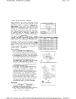
Major aquifers, well yields, estimated natural recharge, number of index wells and date of last water-level sweep are shown in Table 8.1-6. Figure 8.1-6 shows aquifer flow direction and water-level change between 1991-1992 and 2002- 2003 for the entire Phoenix AMA.

The Rangeland Administration System (RAS) provides grazing administrative support and management reports for the BLM and the public. The Rangeland Administration system serves as an electronic calendar for issuance of approximately 18,000 applications and 2,400 grazing authorizations (Permits, Leases, and Exchange-of-Use Agreements) per year, eliminating the need for manually processing these forms.

Phase I Environmental Site Assessment (ESA) for an approximately 60.4-hectare (149.3-acre) site in Maricopa County, Arizona (6L Ranch).

This technical memorandum was prepared to summarize results of drilling, construction, equipping, and testing at hydrologic test wells HRES-10 and HRES-11. The wells were installed to characterize hydrogeologic conditions in the Apache Leap Tuff (Tal) in the southeast extent of the Tal outcrop area near Mineral Creek. Monitoring data obtained from HRES-10 and HRES-11 will be incorporated into the RCM hydrologic monitoring program.

Resolution Copper Mining Company (RCM), acting jointly with Rio Tinto (RT-OTX), asked Mark Logsdon (Geochimica, Inc, Aptos, CA) to prepare a plan to geochemically characterize the rock mass that may be subject to chemical weathering as a consequence of block-caving operations at The Resolution property near Superior, Arizona. Results from this study will be used by RCM and its contractors to develop a geochemical model of the block-cave zone as it affects operational and closure considerations.

The basic objective of this guide is to help engineers, planners, environmental specialists, and road managers make good decisions, protect the environment, and build good low-volume roads.

This report summarizes the meteorological, upper air, nitrogen dioxide (NO2), sulfur dioxide (SO2), ozone (O3), and particulate matter (PM) data collected at the Resolution Copper Project near Superior, Arizona for the first quarter, January 1 – March 31, 2016.

We present a new empirical ground motion model for PGA, PGV, PGD and 5% damped linear elastic response spectra for periods ranging from 0.01–10 s. The model was developed as part of the PEER Next Generation Attenuation (NGA) project. We used a subset of the PEER NGA database for which we excluded recordings and earthquakes that were believed to be inappropriate for estimating free-field ground motions from shallow earthquake mainshocks in active tectonic regimes.