Breadcrumb

  1. Home
  2. Documents
  3. Baseline Reports

Baseline Reports

The documents listed below represent baseline information collected by Resolution Copper and provided to the Tonto National Forest to be used as a partial basis for the analysis in the EIS. The Tonto National Forest will independently evaluate any data provided by Resolution Copper that is used in the EIS to ensure that it is valid, adequate to support the analysis, and represents the best available science.

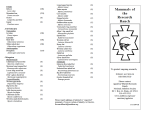
List of mammals [confirmed by observation or sign; suspected, but not confirmed; resident, common; occasional].

The purpose of this tech memo is to describe and present the results of a ADEQ Tier 1 geochemical characterization program of development rock for proposed Shaft No. 10 based detailed sampling and analysis of samples from a pilot drill hole along the entire vertical section of the proposed shaft.

Resolution Copper Company commissioned Golder and Associates to establish a program for the collection of baseline surface water data near the future RCC mine and associated facilities.  The intended uses of the data are primarily to support and EIS, develop a sound conceptual site model as a basis for predicting future impacts, and document current conditions as a baseline for judging future impacts.

Arizona hedgehog cactus survey was conducted on the approximately 1,224-hectare Federal Parcel. The parcel is on the Tonto National Forest east of the Town of Superior. Resolution proposes to obtain the Parcel by way of a land exchange.

A bat survey was conducted on the approximately 1,224-hectare Federal Parcel, in the Tonto National Forest. The purpose of this survey was to determine which bat species could be confirmed present on Parcel.

A raptor survey was conducted on the approximately 1,224-hectare Federal Parcel, in the Tonto National Forest. The purpose of this survey was to determine which raptor species could be confirmed on the Parcel.

Reptile and amphibian survey was conducted on the approximately 1,224-hectare Federal Parcel.

This report summarizes the biological resources of one parcel of U.S. Forest Service land (the Federal Parcel) and five privately owned parcels (the Offered Lands). The work was conducted in anticipation of a possible land exchange.

This report compares the floodplain and wetlands inventories for five offered lands ("Non-Federal Parcels") to the "Federal Parcel". The Non-Federal Parcels are: JX Ranch, Appleton Ranch, LX Bar Ranch, 6L Ranch, 7B Ranch. The Federal Parcel is also known as the Resolution Parcel, and will be so referenced in this report.

Ecological Overview for approximately 60.4 hectares in Maricopa County, Arizona. This ecological evaluation was conducted to identify the type and relative condition of the biological resources found and evaluate ecological characteristics of the property to identify remarkable resources attributes, and to briefly assess their conservation values in reference to local and regional contexts.