Documents Cited - General Plan of Operations
|
Tonto National Forest Plan | U.S. Forest Service. 1985b. Tonto National Forest Land and Resource Management Plan. U.S. Forest Service, Southwestern Region. October. Download PDF |
|
Training Guide for Reclamation, Bond Estimation, and Administration | U.S. Forest Service. 2004. Training Guide for Reclamation Bond Estimation and Administration: For Mineral Plans of Operations authorized and administered under 36 CFR 228A. Washington D.C.: U.S. Forest Service. April. Download PDF |
|
Legends of the Superior Trail | U.S. Forest Service. 2013a. The Legends of Superior Trails: Pinal to the Arizona Trail. Available at: Download Legends of Superior Trails PDF. Accessed January 18, 2019. Download PDF |
|
Screening / Scoping Level Probabilistic Seismic Hazard Analyses | URS Corporation, 2002, Screening/scoping level probabilistic seismic hazard analyses for Granite Reef Diversion and Theodore Roosevelt Dams, Salt River Project: unpublished report prepared for the U.S. Bureau of Reclamation. Download PDF |
|
Site-Specific Seismic Hazard Evaluation of the Lake Roberts Dam, New Mexico | URS Corporation, 2011, Site-specific seismic hazard evaluation of the Lake Roberts Dam, New Mexico: unpublished report prepared for U.S. Fish and Wildlife Service. Download PDF |
|
County Data for Gila and Pinal Counties, Arizona | US Census Bureau. 2010. American Fact Finder. DP-1. Profile and General Population and Housing Characteristics 2010. County Data for Gila and Pinal counties, Arizona. Available at US Census Bureau Census Data. Accessed April 10, 2012. Download PDF |
|
Community Data for Bylas, Claypool, Globe, Hayden, Kearny, Miami, Peridot, San Carlos, Superior, and Winkelman, Arizona | US Census Bureau. 2011. American Fact Finder. DP05. ACS Demographic and Housing Estimates 2007 – 2001 American Community Survey 5-Year Estimates. Community Data for Bylas, Claypool, Globe, Hayden, Kearny, Miami, Peridot, San Carlos, Superior, and Winkelman, Arizona. Available at US Census Bureau Census Data. Accessed October 30, 2013. Download PDF |
|
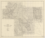
Arizona, Gila and Salt River Meridian Map | USDA Forest Service. 1930. Crook National Forest. Arizona, Gila and Salt River Meridian Map (on file, Arizona Historical Society, Tucson). Download PDF |
|
National Forest Management Act Planning Rule | USDA Forest Service. 1982. National Forest Management Act Planning Rule. Available online at: National Forest System Land and Resource Management Planning (Accessed August 4, 2014). Download PDF |
|
FSM 2800 – Minerals and Geology | USDA Forest Service. 1990. FSM 2800 – Minerals and Geology, Chapter 2840 Reclamation. Amendment 2800-90-1. June 1, 1990. Download PDF |
|
Habitat Planning and Evaluation | USDA Forest Service. 1991. FSM 2600 – Wildlife, Fish, and Sensitive Plant Habitat Management, Chapter 2620 – Habitat Planning and Evaluation. Amendment No. 26000-91-5. July 19, 1991. Download PDF |
|
Road Management Policy | USDA Forest Service. 2001. Road Management Policy. January 2001. Download PDF |
|
Threatened, Endangered and Sensitive Plants and Animals | USDA Forest Service. 2005. FSM 2600 – Wildlife, Fish, and Sensitive Plant Habitat Management, Chapter 2670 Threatened, Endangered and Sensitive Plants and Animals. Amendment 2600-2005-1. September 23, 2005. Download PDF |
|
Special Use Permit Authority: Federal Land Policy and Management Act | USDA Forest Service. 2008. Special Use Permit Authority: Federal Land Policy and Management Act, as Amended October 21, 1976. Executed October 29, 2008, expires October 31, 2018. Download PDF |
|
Noxious Weed Management | USDA Forest Service. 2009. FSM 2000 – National Forest Resource Management, Chapter 2080 Noxious Weed Management. Amendment 2000-2009-1. April 3, 2009. Download PDF |
|
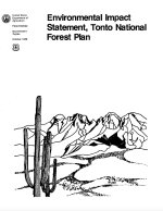
Environmental Impact Statement Tonto National Forest Plan | USDA Forest Service. Tonto National Forest. 1985a. Environmental Impact Statement Tonto National Forest Plan, Forest Services, Southwestern Region. October 1985. Download PDF |
|
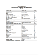
Tonto National Forest Sensitive Species List | USDA Forest Service. Tonto National Forest. 2011. Tonto National Forest Sensitive Species List. US Forest Service, Tonto National Forest. Phoenix, Arizona. Accessed October 21, 2013. Download PDF |
|
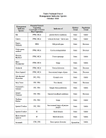
Tonto National Forest Management Indicator Species | USDA Forest Service. Tonto National Forest. 2012. Tonto National Forest Management Indicator Species. October 2012. Download PDF |
|
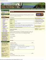
Oak Flat | USDA Forest Service. Tonto National Forest. 2014. Tonto National Forest. Oak Flat. Available at: Oak Flat Campground. Accessed August 27, 2014. Download PDF |

