Documents Cited - General Plan of Operations
|
Empirical Response Spectral Attenuation Relations for Shallow Crustal Earthquakes | Abrahamson, N.A. and Silva, W.J., 1997, Empirical response spectral attenuation relations for shallow crustal earthquakes: Seismological Research Letters, v. 68, p. 94-127. Download PDF |
|
Summary of the Abrahamson and Silva NGA Ground Motion Relations | Abrahamson, N.A. and Silva, W.J., 2008, Summary of the Abrahamson and Silva NGA ground motion relations. Earthquake Spectra, v. 24, p. 67-97. Download PDF |
|
Kinetics of Sulfur Oxidation at Suboptimal Temperature | Ahonen, L. and Tuovinen, O.H. 1990. Kinetics of sulfur oxidation at suboptimal temperature. Applied and Environmental Microbiology, v. 56, p. 560-562. Download PDF |
|
Resolution Copper Mining Monitoring Plan | Air Sciences. 2011. Resolution Copper Mining Monitoring Plan. November 2011. Download PDF |
|
Resolution Baseline Report | Air Sciences. 2012. Resolution Baseline Report: Prepared for Resolution Copper a Member of Rio Tinto Group. June 2012. Download PDF |
|
Baseline Meteorological and Air Quality Data Annual Report Resolution Copper Mining Project: April 1, 2012 – March 31, 2013 | Air Sciences. 2013. Baseline Meteorological and Air Quality Data Annual Report Resolution Copper Mining Project: April 1, 2012 – March 31, 2013. Prepared for Resolution Copper a Member of Rio Tinto Group August 2013. Download PDF |
|
Baseline Meteorological and Air Quality Data Report Resolution Copper Mining Project April 1-June 30, 2012 | Air Sciences. 2013a. Baseline Meteorological and Air Quality Data Reports. Resolution Copper Mining Project. Quarterly reports for the period April 1, 2012 – June 30, 2012. Prepared for Resolution Copper a Member of Rio Tinto Group November 2012. Download PDF |
|
Century-Long Average Time Intervals Between Earthquake Ruptures of the San Andreas Fault in the Carrizo Plain, California | Akciz, S.O., Grant Ludwig, L., Arrowsmith, J R., and Zielke, O., 2010, Century-long average time intervals between earthquake ruptures of the San Andreas fault in the Carrizo Plain, California: Geology, v. 38, p. 787-790. Download PDF |
|
Seismological Evidence in Support of the Existence of “Characteristic Earthquakes” | Aki, K., 1983, Seismological evidence in support of the existence of “Characteristic Earthquakes”: Earthquake Notes, v. 54, p. 60-61. Download PDF |
|
Pilot Plant Test Work | ALS (2014) Pilot Plant Test Work, Resolution Copper Project, Rio Tinto. Report KM4420, December 19, 2014. Download PDF |
![Download and review Standard Test Methods for Laboratory Compaction Characteristics of Soil Using Standard Effort (12 400 ft-lbf/ft3 [600 kN-m/m3]) document Thumbnail image of Standard Test Methods for Laboratory Compaction Characteristics of Soil Using Standard Effort (12 400 ft-lbf/ft3 [600 kN-m/m3]) first page](/sites/default/files/styles/document_cover_narrow_scale_width_150/public/thumbnails/astm-D698-cover.png?itok=mAqO8HaB)
|
Standard Test Methods for Laboratory Compaction Characteristics of Soil Using Standard Effort (12 400 ft-lbf/ft3 [600 kN-m/m3]) | American Society for Testing and Materials. D698. Standard Test Methods for Laboratory Compaction Characteristics of Soil Using Standard Effort (12 400 ft-lbf/ft3 [600 kN-m/m3]) Download PDF |
|
Standard Test Method for Accelerated Weathering of Solid Materials Using a Modified Humidity Cell | American Society for Testing and Materials. 1996. Standard Test Method for Accelerated Weathering of Solid Materials Using a Modified Humidity Cell. Designation: D 5744 – 96 (Reapproved 2001). West Conshohocken, Pennsylvania: ASTM International. Download PDF |
|
ARD Test Handbook | AMIRA. 2002. ARD Test Handbook. Project P387A. Prediction and Kinetic Control of Acid Mine Drainage, AMIRA International Limited, Melbourne, Australia. Download PDF |
|
Estimating the Seismicity From Geological Structure for Seismic Risk Studies | Anderson, J.G., 1979, Estimating the seismicity from geological structure for seismic risk studies: Bulletin of the Seismological Society of America, v. 69, p. 135-158. Download PDF |
|
Seismotectonic Investigations, Stewart Mountain Dam, Salt River Project, Arizona | Anderson, L.W., Piety, L.A., and Hansen, R.A., 1986, Seismotectonic investigations, Stewart Mountain Dam, Salt River Project, Arizona: U. S. Bureau of Reclamation Seismotectonic Report 86-2, 41 p. Download PDF |
|
Community Profile - Gila County | Arizona Department of Commerce. 2009. Community Profile. Gila County: Arizona. Available at: County Profiles. (Accessed May 29, 2012). Download PDF |
|
Community Profile - Globe-Miami, Arizona | Arizona Department of Commerce. 2009a. Community Profile. Globe-Miami: Arizona. Available at: Community Profiles. Accessed March 26, 2012. Download PDF |
|
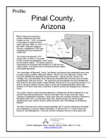
Community Profile - Pinal County | Arizona Department of Commerce. 2009b. Community Profile. Pinal County: Arizona. County Profiles. Accessed June 13, 2011. Download PDF |
|
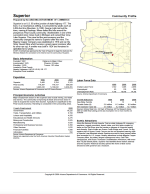
Community Profile - Superior, Arizona | Arizona Department of Commerce. 2009c. Community Profile. Superior: Arizona. Available at: Community Profiles. Accessed March 26, 2012. Download PDF |
|
Arizona Mining Guidance Manual BADCT, Aquifer Protection Program | Arizona Department of Environmental Quality. 2004. Arizona Mining Guidance Manual BADCT. Aquifer Protection Program. Publication No. TB-04-01. Phoenix, Arizona: Arizona Department of Environmental Quality. Download PDF |
|
Arizona State Implementation Plan, Regional Haze Under 308 of the Federal Regional Haze Rule | Arizona Department of Environmental Quality. 2011. Arizona State Implementation Plan (SIP). Regional Haze Under 308 of the Federal Regional Haze Rule. Air Quality Division. January 2011. Download PDF |
|
2010 Status of Water Quality Arizona’s Integrated 305(b) Assessment and 303(d) Listing Report | Arizona Department of Environmental Quality. 2012. 2010 Status of Water Quality. Arizona’s Integrated 305(b) Assessment and 303(d) Listing Report. June 2012. Available at: 2010 Water Quality Report. Accessed July 30, 2012. Download PDF |
|
State of Arizona Area-Wide Aquifer Protection Permit No. P-101703 | Arizona Department of Environmental Quality. 2012a. State of Arizona Area-Wide Aquifer Protection Permit No. P-101703. Place ID No. 7820, LTF No. 54902. March 29, 2012. Download PDF |
|
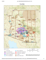
Map of Nonattainment, Attainment Areas, and Maintenance Areas | Arizona Department of Environmental Quality. 2013. E-Maps. Map of Nonattainment, Attainment Areas, and Maintenance Areas. ADEQ: eMaps. Accessed July 25, 2013. Download PDF |
|
Current List of Scenic Roads - Phoenix and Central Arizona | Arizona Department of Transportation. Undated. Available at: [Link Outdated]. |
|
Phoenix Metro Area Projects State Route 24 | Arizona Department of Transportation (ADOT). 2013. Phoenix Metro Area Projects. State Route 24. Overview. Available at: State Route 24. Accessed November 12, 2013. Download PDF |
|
Third Management Plan for Phoenix Active Management Area 2000-2010 | Arizona Department of Water Resources. 1999. Third Management Plan for Phoenix Active Management Area 2000-2010. December 13, 1999. Available at: ADWR Third Management Plan. Accessed July 30, 2013. Download PDF |
|
Arizona Water Atlas Volume 8 Active Management Area Planning Area | Arizona Department of Water Resources. 2010. Arizona Water Atlas Volume 8 Active Management Area Planning Area. April 2010. Download PDF |
|
Groundwater Site Inventory (GWSI) Database | Arizona Department of Water Resources. 2013. Groundwater Site Inventory (GWSI) database. Available at: GWSI Database. Accessed data August 6, 2013. Download PDF |
|
Upper Mineral Creek Trip Report | Arizona Game and Fish Department. 2006. Upper Mineral Creek Trip Report. Download PDF |
| Where to Hunt - Statewide Game Management Unit Map | Arizona Game and Fish Department. 2011. Where to Hunt Accessed June 29, 2011. |
|
|
Regional Soils | Arizona Land Resource Information System. 1975. Regional Soils: GIS Cover. Available at: [Link Outdated]. Accessed March 13, 2015. |
|
Arizona Laws Relating to Water | Arizona Laws Relating to Water, State Bar of Arizona. 2011. Reprinted from LexisNexis Arizona Annotated Revised Statutes, 2010-2011 Edition. Download PDF |
|
Boyce Thompson Arboretum State Park | Arizona State Parks. 2014. Boyce Thompson Arboretum State Park. Available at: Arizona State Parks. Accessed August 27, 2014. Download PDF |
|
What is the Arizona Trail? | Arizona Trail Association. 2014. What is the Arizona Trail? Available at: The Trail. Accessed August 27, 2014. Download PDF |
|
Correlation of Response Spectral Values for Multi-Component Ground Motions | Baker J.W. and Cornell C.A., 2006, Correlation of response spectral values for multi-component ground motions: Bulletin of the Seismological Society of America, v. 96, p. 215-227. Download PDF |
|
The Conditional Mean Spectrum: A Tool for Ground Motion Selection | Baker, J.W., 2011, The conditional mean spectrum: A tool for ground motion selection,” American Society of Civil Engineers, Journal of Structural Engineering, v. 137, p. 322-331. Download PDF |
|
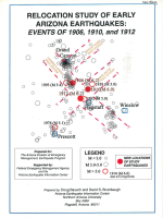
Relocation Study of Early Arizona Earthquakes: Events of 1906, 1910, and 1912 | Bausch, D. and Brumbaugh, D.A., 1997, Relocation study of early Arizona earthquakes: Events of 1906, 1910, and 1912: unpublished report prepared for Arizona Division of Emergency Management, Earthquake Program, 65 p. + Appendices. Download PDF |
|
Nonlinear Soil-Site Effects in Probabilistic Seismic-Hazard Analysis | Bazzurro, P. and Cornell, C.A., 2004, Nonlinear soil-site effects in probabilistic seismic-hazard analysis: Bulletin of the Seismological Society of America, v. 94, p. 2110-2123. Download PDF |
|
Resolution Copper Mine Pre-Feasibility Study Refrigeration and Ventilation Strategy | BBE Consulting Morvent Mining. 2012. Resolution Copper Mine Pre-Feasibility Study Refrigeration and Ventilation Strategy. October 2012. Download PDF |
|
Engineering Rock Mass Classifications | Bieniawski, Z.T. 1989. Engineering Rock Mass Classifications a Complete Manual for Engineers and Geologists in Mining, Civil and Petroleum Engineering. Download PDF |
|
Phase I Hydrogeologic Field Investigations, Near West Tailings Site, Pinal County, Arizona | Blainer-Fleming, J., J. Meyer, and M. Cross. 2013. Phase I Hydrogeologic Field Investigations, Near West Tailings Site, Pinal County, Arizona. Project: 605.76. Technical memorandum. Tucson, Arizona: Montgomery and Associates. May 1. Download PDF |
|
Ground Motion Predictive Equations for the Average Horizontal Component of PGA, PGV, and 5% Damped PSA at Spectral Periods Between 0.01s to 10.0s | Boore, D.M., and Atkinson, G.M., 2008, Ground motion predictive equations for the average horizontal component of PGA, PGV, and 5% damped PSA at spectral periods between 0.01s to 10.0s: Earthquake Spectra, v. 24, p. 99-138. Download PDF |
|
Biotic Communities: Southwestern United States and Northwestern Mexico | Brown, D.E. (ed.). 1994. Biotic Communities: Southwestern United States and Northwestern Mexico. Salt Lake City, Utah: University of Utah Press. Download PDF |
|
Biotic Communities of the Southwest | Brown, David E.; Lowe C. H. 1980. Biotic communities of the Southwest. GTR-RM-78. Fort Collins, CO: US Department of Agriculture, Forest Service. Rocky Mountain Range and Experiment Station. Download PDF |
|
A Tectonic Boundary for the Southern Colorado Plateau | Brumbaugh, D. S., 1987, A tectonic boundary for the Southern Colorado Plateau: Tectonophysics, v. 136, p. 125-136. Download PDF |
|
Estimation of Rock Mass Deformation Modulus and Strength of Jointed Hard Rock Masses Using the GSI System | Cai, M, Kaiser, P.K., Uno, H., Tasaka, Y., Minami, M. 2004. Estimation of rock mass deformation modulus and strength of jointed hard rock masses using the GSI system. International Journal of Rock Mechanics and Mining Sciences. Accepted February 19, 2003 Download PDF |
|
NGA Ground Motion Model for the Geometric Mean Horizontal Component of PGA, PGV, PGD, and 5% Damped Linear Elastic Response Spectra for Periods Ranging From 0.01 to 10s | Campbell, K.W. and Bozorgnia, Y., 2008, NGA ground motion model for the geometric mean horizontal component of PGA, PGV, PGD, and 5% damped linear elastic response spectra for periods ranging from 0.01 to 10s: Earthquake Spectra, v. 24, p. 139-171. Download PDF |
|
The Revised 2002 California Probabilistic Seismic Hazard Maps, June 2003 | Cao, T.C., Bryant, W.A., Rowshandel, B., Branum, D., and Wills, C.J., 2003, The revised 2002 California probabilistic seismic hazard maps, June 2003: California Geological Survey website. Download PDF |
|
The Changing Value of Water to the US Economy: Implications from Five Industrial Sectors | CH2M Hill. 2012. Matachich, M., Mierzejewski, M., Byers, B., Pitzler, D. and Ahmed, S. The Changing Value of Water to the US Economy: Implications from Five Industrial Sectors, CH2M Hill. Download PDF |
|
An NGA Model for the Average Horizontal Component of Peak Ground Motion and Response Spectra | Chiou, B.S.J. and Youngs, R.R., 2008, An NGA model for the average horizontal component of peak ground motion and response spectra: Earthquake Spectra, v. 24, p. 173-215. Download PDF |
|
Roadside Geology of Arizona | Chronic, Halka. 1983. Roadside Geology of Arizona. Mountain Press Publishing Co. Missoula. Download PDF |
|
Community profiles for Superior, Miami, Globe, Hayden, Winkelman, Kearny, San Carlos, and Peridot, Arizona | City-data.com. 2012. Community profiles for Superior, Miami, Globe, Hayden, Winkelman, Kearny, San Carlos, and Peridot, Arizona. Available at: City-Data. Accessed June 14, 2012. Download PDF |

|
San Carlos, Arizona | City-data.com. 2013. San Carlos, Arizona. Available at: City-Data. Accessed October 30, 2013. Download PDF |

|
The New Deal in Arizona | Collins, William S. 1999. The New Deal in Arizona. Arizona State Parks Board, Phoenix. Download PDF |
|
Engineering Seismic Risk Analysis | Cornell, C.A., 1968, Engineering seismic risk analysis: Bulletin of the Seismological Society of America, v. 58, p. 1583-1606. Download PDF |
|
Hydrogeologic Data Submittal, Tailings Prefeasibility Study, Whitford, Silver King, and Happy Camp Sites | Cross, M., and J. Blainer-Fleming. 2012. Hydrogeologic Data Submittal, Tailings Prefeasibility Study, Whitford, Silver King, and Happy Camp Sites. Project: 605.741. Draft technical memorandum. Tucson, Arizona: Montgomery and Associates Inc. October 23. Download PDF |
|
Devils Canyon Drainage Stock Tank Surveys During 2010 and 2011 | Crowder, C.D. and A.T. Robinson. 2011. Devils Canyon drainage stock tank surveys during 2010 and 2011. Arizona Game and Fish Department, Phoenix. 9pp. Download PDF |
|
Final Report Describing Flotation Testing on Master Cumpusile No. 1 (RES 2C-2, 3-1 and 3A-1) from the Resolution Project | Dawson Metallurgical Laboratories. 2002. Final Report Describing Flotation Testing on Master Composite No. 1 (RES 2C-2, 3-1 and 3A-1) from the Resolution Project, Report to Rio Tinto Technical Services, Project No. P-2694E, November 11, 2002. Download PDF |
|
The Maximum Background Earthquake for the Basin and Range Province, Western North America | dePolo, C.M., 1994, The maximum background earthquake for the Basin and Range Province, western North America: Bulletin of the Seismological Society of America, v. 84, p. 466-472. Download PDF |
|
Arizona Earthquakes, 1776-1980 | DuBois, S.M., A.W. Smith, N.K. Nye, and T.A. Nowak Jr. 1982. Arizona Earthquakes, 1776–1980. Bulletin 193. Prepared by State of Arizona, Bureau of Geology and Mineral Technology, Geological Survey Branch. Download PDF |

|
Surface Complexation Modeling – Hydrous Ferric Oxide | Dzomback, D.A. and Morel F.M.M. (1990) Surface Complexation Modeling – Hydrous Ferric Oxide. New York, John Wiley, 393 p. Download PDF |
|
Hardrock Metal Mining Pit Lakes: Occurrence and Geochemical Characteristics | Eary, L. E. and D. Castendyk (2013) Hardrock Metal Mining Pit Lakes: Occurrence and Geochemical Characteristics. Chapter 3.2.2 In Acidic Pit Lakes (M. Schultz and W. Geller, Eds.), Springer, Berlin, pp. 75-106. Download PDF |
|
Geochemical and Equilibrium Trends in Existing Mine Pit Lakes | Eary, L.E. (1999) Geochemical and equilibrium trends in existing mine pit lakes. Applied Geochemistry 14, 963-987. Download PDF |
|
Linking GoldSim with the PHREEQC Geochemical Model with a Dynamic Link Library | Eary, T. (2007) Linking GoldSim with the PHREEQC Geochemical Model with a Dynamic Link Library. 2007 GoldSim User’s Conference, San Francisco, CA. Download PDF |
|
Guidelines for Determining Design Basic Ground Motions | Electric Power Research Institute (EPRI), 1993, Guidelines for determining design basic ground motions, v. 1: Method and guidelines for estimating earthquakes ground motion in eastern North America: EPRI Report TR-102293. Download PDF |
|
Economic & Fiscal Impact of Resolution Copper Company – Superior, Arizona | Elliot D. Pollack and Company. 2011. Resolution Copper Company Economic and Fiscal Impact Report, Superior Arizona. Scottsdale, Arizona: Elliott D. Pollack and Company. September. Download PDF |
|
Appendix I: Calculating California Seismicity Rates | Felzer, K.R., 2008, Calculating California seismicity rates, Appendix I in the Uniform California Earthquake Rupture Forecast, version 2: U.S. Geological Survey Open-File Report 2007- 1437I. Download PDF |
|
Geology of the Florence Junction and Southern Portion of the Weavers Needle 7.5' Quadrangles, Pinal County, Arizona | Ferguson, C.A. and Skotnicki, S.J., 1995, Geology of the Florence Junction and southern portion of the Weavers Needle 7.5' Quadrangles, Pinal County, Arizona: Arizona Geological Survey Open-File Report 95-10, includes 1:24,000 scale geologic map, cross-sections, 27 p. Download PDF |
|
Geologic Map of the Florence Junction and Southern Portion of the Weavers Needle 7.5' Quadrangles, Pinal County, Arizona | Ferguson, C.A., and S.J. Skotnicki. 1996. Geologic Map of the Florence Junction and Southern Portion of the Weavers Needle 7.5' Quadrangles, Pinal County, Arizona. Tucson: Arizona Geological Survey. Download PDF |
|
Drainage Design Manual for Maricopa County; Hydrology | Flood Control District of Maricopa County (FCD). 2011. Drainage Design Manual for Maricopa County; Hydrology. February 2011. Download PDF |
|
Mapping Seismic Hazard in the Central and Eastern United States | Frankel, A., 1995, Mapping seismic hazard in the central and eastern United States: Seismological Research Letters, v. 66, p. 8-21. Download PDF |
|
Draft Final Proposal for Geochemical Characterization of Resolution Copper Mining Block-Caving Zone | Geochimica, 2008. Draft Final Proposal for Geochemical Characterization of Resolution Copper Mining Block-Caving Zone. Prepared by Mark J. Logsdon (Geochimica), Prepared for Craig Stevens (Rio Tinto) and Bruce Marsh (Resolution Copper Mining), April 19, 2008. Download PDF |
|
Gila County Comprehensive Plan: Chapter 2 | Gila County Comprehensive Plan. 2003. Gila County Comprehensive Plan: Chapter 2. Available at Gila County Planning and Zoning. Accessed November 11, 2013. Download PDF |
|
Site Characterization Report for the West Plant Site | Golder Associates Inc. 2011. Site Characterization Report for the West Plant Site, Superior, Arizona. Project No. 073-92519-02. Redmond, Washington: Golder Associates Inc. December. Download PDF |
|
Aquifer Protection Permit Application, West Plant Site, Superior Mine, Superior, Arizona, Volume 3 - Appendices | Golder Associates. 2005. Aquifer Protection Permit Application, West Plant Site, Superior Mine, Superior, Arizona, Volume 3 - Appendices. June 24, 2005, Report ref. 053-2519. Download PDF |
|
Resolution Copper Company Surface Water Baseline Report October 2002 Through February 2006 | Golder Associates. 2006. Resolution Copper Company, Surface Water Baseline Report, October 2002 through February 2006: Final report prepared for Resolution Copper Company, June 30, 2006. Download PDF |

|
Geochemical Characterization of Cleaner and Scavenger Tailings | Golder Associates. 2007. Geochemical Characterization of Cleaner and Scavenger Tailings – Resolution Copper Project, Technical Memorandum to Resolution Copper Mining, Project No. 073-92548, December 11, 2007. Download PDF |
|
Well Installation Report for New Point of Compliance and Alert Wells | Golder Associates. 2007. Well Installation Report for New Point of Compliance and Alert Wells, West Plant Site, Superior, Arizona, November 21, 2007, Report ref. 073-92522. Download PDF |
|
Report on Groundwater Model of West Plant Site | Golder Associates. 2008. Report on Groundwater Model of West Plant Site, Superior Arizona. March 24, 2008. Download PDF |
|
Kinetic Testing Results of Scavenger Tailings – Resolution Copper Project | Golder Associates. 2009. Kinetic Testing Results of Scavenger Tailings – Resolution Copper Project, Technical Memorandum to Resolution Copper Mining, Project No. 073-92548-01.001, January 12, 2009. Download PDF |
|
Intermediate Rock Stockpile Type 2.02 General Aquifer Protection Permit | Golder Associates. 2010. Intermediate Rock Stockpile Type 2.02 General Aquifer Protection Permit (Notice of Intent and Supplemental Information). December 1, 2010. Download PDF |
|
Aquifer Protection Permit Application Development Rock Stockpile Project, West Plant | Golder Associates. 2011. Aquifer Protection Permit Application Development Rock Stockpile Project, West Plant Site, Superior, Arizona. May 6, 2011. Download PDF |
|
Loadout Intermediate Rock Stockpile Type 2.02 General Aquifer Protection Permit | Golder Associates. 2011a. Loadout Intermediate Rock Stockpile Type 2.02 General Aquifer Protection Permit (Notice of Intent and Supplemental Information) May 17, 2011. Download PDF |
|
Groundwater Assessment Update: West Plant Site, Superior, Arizona: Technical Memorandum | Golder Associates. 2013. Groundwater Assessment Update: West Plant Site, Superior, Arizona: Technical Memorandum prepared for Resolution Copper Company, March 28, 2013. Download PDF |
|
Field Testing Program, Resolution Copper Project – 2012-2013 Geochemical Annual Evaluation and Final Assessment | Golder Associates. 2013. Field Testing Program, Resolution Copper Project – 2012-2013 Geochemical Annual Evaluation and Final Assessment, Report to Resolution Copper Mining, Project No. 073-92548-01.005, April 2013. Download PDF |
|
Mined Land Reclamation Plan – Superior Mine, Arizona | Golder Associates. 2014. Mined Land Reclamation Plan – Superior Mine, Arizona, Resolution Copper Mining, LLC. April 22, 2014. Download PDF |
|
Rupture History of the San Andreas Fault in the Carrizo Plain prior to 1300 A.D. | Grant Ludwig, L. and Akciz, S., 2012, Rupture History of the San Andreas Fault in the Carrizo Plain prior to 1300 A.D., Final Technical Report, U.S. Geological Survey National Earthquake Hazard Reduction Program Award No. G10AP00073. Download PDF |
|
Climate-Modulated Channel Incision and Rupture History of the San Andreas Fault in the Carrizo Plain | Grant Ludwig, L., Akciz, S.O., Noriega, G. R., Zielka, O., and Arrowsmith, J R., 2010. Climate modulated channel incision and rupture history of the San Andreas fault in the Carrizo Plain: Science, v. 327, p. 1117-111. Download PDF |
|
Stratigraphic Evidence for 7 Meters of Dextral Slip on the San Andreas Fault During the Great 1857 Earthquake in the Carrizo Plain | Grant, L. and Sieh, K., 1993, Stratigraphic evidence for 7 meters of dextral slip on the San Andreas fault during the great 1857 earthquake in the Carrizo Plain: Bulletin of the Seismological Society, v 83, 619-635. Download PDF |
|
1855 and 1991 Surveys of the San Andreas Fault: Implications for Fault Mechanics | Grant, L.B. and Donnellan, A., 1994, 1855 and 1991 surveys of the San Andreas Fault; implications for fault mechanics: Bulletin of the Seismological Society of America, v. 84, p. 241-246. Download PDF |
|
Paleoseismic Evidence of Clustered Earthquakes on the San Andreas Fault in the Carrizo Plain, CA | Grant, L.B. and Sieh, K., 1994, Paleoseismic evidence of clustered earthquakes on the San Andreas fault in the Carrizo Plain, CA.: Journal of Geophysical Research, v. 99, p. 6819- 6842. Download PDF |
|
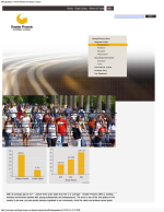
Regional Profile Demographics | Greater Phoenix Economic Council. 2013. Regional Profile Demographics. Available at: Phoenix Demographics and Workforce. Accessed October 30, 2013. Download PDF |
|
A Bilinear Source-Scaling Model for M–log A Observations of Continental Earthquakes | Hanks, T.C. and Bakun, W.H., 2002, A bilinear source-caling model for M-log A observations of continental earthquakes: Bulletin of the Seismological Society of America, v. 92, p. 1841- 1846. Download PDF |
|
A Moment Magnitude Scale | Hanks, T.C. and Kanamori, H. 1979, A moment magnitude scale: Journal of Geophysical Research, v. 84, p. 2348-2350. Download PDF |
|
Resolution Project Geochemistry: Prediction of Block Cave Water Chemistry | Hatch. 2016. Appendix Q: Final Draft Report: Prediction of Block Cave Water Chemistry. In General Plan of Operations, Resolution Copper Mining. Scottsdale, Arizona: Hatch. January 8. Download PDF |
|
Geology and Exploration Progress at the Resolution Porphyry Cu-Mo Deposit, Arizona | Hehnke, C., G. Ballantyne, H. Martin, W. Hart, A. Schwarz, and H. Stein. 2012. Geology and exploration progress at the Resolution porphyry Cu-Mo deposit, Arizona. Society of Economic Geologists, Inc.(Special Publication 16):147-166. Download PDF |
|
Fracture and Dike Patterns in Laramide Plutons and Their Structural and Tectonic Implications | Heidrick, T.L., and Titley, S.R. 1982. Fracture and dike patterns in Laramide plutons and their structural and tectonic implications, in Titley, S.R., ed., Advances in geology of the porphyry copper deposits, southwestern United States: Tucson, University of Arizona Press, p. 73-92. Download PDF |
|
Study and Interpretation of the Chemical Characteristics of Natural Water | Hem, J.D. 1985. Study and Interpretation of the Chemical Characteristics of Natural Water. U.S. Geological Survey Water-Supply Paper No. 2254, 3rd Edition. Download PDF |
|
Surficial Geology of the Superstition Mountain Piedmont Area, Northern Pinal and Eastern Maricopa Counties, Arizona | Huckleberry, G., 1993, Surficial Geology of the Supersition Mountain Piedmont Area, Northern Pinal and Eastern Maricopa Counties, Arizona: OFR-93-15, scale 1:24,000, 6 sheets, 33 p. Download PDF |
|
Seismic Response of Horizontal Soil Layers | Idriss, I.M. and Seed, H.B., 1968, Seismic response of horizontal soil layers: Journal of the Soil Mechanics and Foundations Division, v. 94, p. 1003-1031. Download PDF |
|
Three-Point Approximations for Continuous Random Variables | Keefer, D.I. and Bodily, S.E., 1983, Three-point approximations for continuous random variables: Management Science, v. 26, p. 595-609. Download PDF |
|
Low-Volume Roads Engineering Best Management Practices Field Guide | Keller, G and Sherar, J. 2003. Low-Volume Roads Engineering Best Management Practices Field Guide. July 2003. Download PDF |
|
Tonto National Forest Land and Resource Management Plan: Management Indicator Species Status Report | Klein, E., M. Gilbert, S. Lisius, R. Richards, M. Ross, C. Woods, B. Calamusso, D. Pollock, and J. Spencer. 2005. Tonto National Forest Land and Resource Management Plan: Management Indicator Species Status Report. Version 2.0. Revised. Originally prepared in 2002 U.S. Forest Service. July 15. Download PDF |
|
Resolution Project Tailings Characterization: Static Geochemistry | Klohn Crippen Berger (KCB). 2007. Resolution Project Tailings Characterization: Static Geochemistry, Letter Report to Resolution Copper Mining, December 6, 2007. Download PDF |
|
Resolution Project 2010 Geotechnical Testing of Tailings Samples | Klohn Crippen Berger. 2011. Resolution Project 2010 Geotechnical Testing of Tailings Samples. January 12, 2011. Download PDF |
|
Resolution Copper Mining Near West Tailings Management Mine Plan of Operations Study | Klohn Crippen Berger. 2014. Resolution Copper Mining Near West Tailings Management Mine Plan of Operations Study. September 2014. Download PDF - Report , Download PDF - Appendix I-E , Download PDF - Appendix II |
|
Kinetic Theory in the Earth Sciences | Lasaga, A.C. 1998. Kinetic Theory in the Earth Sciences. Princeton University Press, Princeton, New Jersey. Download PDF |
|
A Practical Manual on Block Caving | Laubscher, D.H., 2000. Block Caving Manual, Prepared for International Caving Study. JKMRC and Itasca Consulting Group, Inc. Brisbane. Download PDF |
|
The MRMR Rock Mass Rating Classification System in Mining Practice | Laubscher, Dr. D.H. and Jakubec, J. 2000. Design Topic: Rock Mass Classification IRMR/MRMR, Bock Cave Manual. Download PDF |
|
A Methodology to Estimate Site-Specific Seismic Hazard for Critical Facilities on Soil or Soft-Rock Sites | Lee, R., Maryak, M.E., and Kimball, J., 1999, A methodology to estimate site-specific seismic hazard for critical facilities on soil or soft-rock sites (abs.): Seismological Research Letters, v. 70, p. 230. Download PDF |
|
Alternatives in Evaluating Soil- and Rock-Site Seismic Hazard | Lee, R., Silva, W.J., and Cornell, C.A., 1998, Alternatives in evaluating soil- and rock-site seismic hazard (abs.): Seismological Research Letters, v. 69, p. 81. Download PDF |
|
1857 Slip on the San Andreas Fault Southeast of Cholame, California | Lienkaemper, J.J., 2001, 1857 slip on the San Andreas fault southeast of Cholame, California: Bulletin of the Seismological Society of America, v. 91, p. 1659-1672. Download PDF |
|
Development and Application of Realistic Earthquake Time Histories Compatible with Multiple-Damping Design Spectra | Lilhanand, K. and Tseng, W.S., 1988, Development and application of realistic earthquake time histories compatible with multiple-damping design spectra: Proceeding of the 9th World Conference on Earthquake Engineering, Tokyo-Kyoto, Japan. Download PDF |
|
Evidence for Two Surface Ruptures in the Past 500 Years on the San Andreas Fault at Frazier Mountain, California | Lindvall, S.C., Rockwell, T.K., Dawson, T.E., Helms, J.G., and Bowman, K.W., 2002, Evidence for two surface ruptures in the past 500 years on the San Andreas fault at Frazier Mountain, California: Bulletin of the Seismological Society of America, v. 92, p. 2689-2703. Download PDF |
|
Six Similar Sequential Ruptures of the San Andreas Fault, Carrizo Plain, California | Liu, J., Klinger, K., Sieh, K., and Rubin, C., 2004, Six similar sequential ruptures of the San Andreas fault, Carrizo Plain, California: Geology, v. 32, p. 649-652. Download PDF |
|
Analysis of Seismic Activity near Theodore Roosevelt Dam, Arizona, during the Occupation of the EarthScope/USArray Transportable Array | Lockridge, J.S., Fouch, M.J., Arrowsmith, J.R., and Linkimer, L., 2012, Analysis of seismic activity near Theodore Roosevelt Dam, Arizona, during the Occupation of the EarthScope/USArray Transportable Array: Bulletin of the Seismological Society of America, v. 83, p. 1014-1022. Download PDF |
|
Geochemical Characterization of Development Rock for Proposed Shaft No. 10, Resolution Project: ADEQ Tier 1 Results and Inertness Analysis | Logsdon, Mark. 2007. Technical Memorandum - Geochemical Characterization of Development Rock for Proposed Shaft No. 10, Resolution Project: ADEQ Tier 1 Results and Inertness Analysis. Download PDF |
|
Basin and Range Province Earthquake Working Group II | Lund, W.R., 2012, Basin and Range Province Earthquake Working Group II Recommendations to the U.S. Geological Survey National Seismic Hazard Mapping Program for the 2014 Update of the National Seismic Hazard Maps: Utah Geological Survey Open-File Report 591, 17 p. Download PDF |
|
Contrasts Between Short- and Long-Term Records of Seismicity in the Rio Grande Rift – Important Implications for Seismic Hazard Assessments in Areas of Slow Extension | Machette, M.N., 1998, Contrasts between short- and long-term records of seismicity in the Rio Grande rift – Important implications for seismic hazard assessments in areas of slow extension, in W.R. Lund (ed.), Western States Seismic Policy Council Proceedings Volume, Basin and Range Province Seismic Hazards Summit, Utah Geological Survey Miscellaneous Publication 98-2, p. 84-95. Download PDF |
|
Synclinal-Horst Basins: Examples From the Southern Rio Grande Rift and Southern Transition Zone of Southwestern New Mexico, USA | Mack, G.H., Seager, W.R., and Leeder, M.R., 2003, Synclinal-horst basins: examples from the southern Rio Grande rift and southern transition zone of southwestern New Mexico: Basin Research, v. 15, p. 365-377. Download PDF |
|
Principles of Geochemistry | Mason, B. and Moore, C.B. 1982. Principles of Geochemistry, John Wiley & Sons, New York. Download PDF |
|
Earthquake Site Conditions in the Wasatch Front Urban Corridor, Utah | McDonald, G.N. and Ashland, F.X., 2008, Earthquake site conditions in the Wasatch Front urban corridor, Utah: Utah Geological Special Study 125, 41 p., 1 plate, scale 1:150,000. Download PDF |
|
Technical Basis for Revision of Regulatory Guidance on Design Ground Motions: Hazard- and Risk-Consistent Ground Motion Spectra Guidelines | McGuire, R.K., Silva, W.J., and Costantino, C.J., 2001, Technical basis for revision of regulatory guidance on design ground motions: Hazard- and risk-consistent ground motion spectra guidelines: U.S. Nuclear Regulatory Commission NUREG/CR-6728. Download PDF |
|
Technical Basis for Revision of Regulatory Guidance on Design Ground Motions: Development of Hazard- and Risk-consistent Seismic Spectra for Two Sites | McGuire, R.K., Silva, W.J., and Costantino, C.J., 2002, Technical basis for revision of regulatory Guidance on design ground motions, report prepared for U.S. Nuclear Regulatory Commission. Download PDF |
|
An Animated Tectonic Reconstruction of Southwestern North America Since 36 Ma | McQuarrie, N., and Wernicke, B.P., 2005, An animated tectonic reconstruction of southwestern North America since 36 Ma: Geosphere, v. 1, p. 147–172. Download PDF |
|
Evidence for the Latest-Miocene to Pliocene Transition from Basin-Range Tectonic to Post-Tectonic Landscape Evolution in Southeastern Arizona | Menges, C.M. and McFadden, L.D., 1981, Evidence for the latest-Miocene to Pliocene transition from Basin-Range tectonic to post-tectonic landscape evolution in southeastern Arizona: Arizona Geological Society Digest, v. 13, p. 151-160. Download PDF |
|
Map of Neotectonic (Latest Pliocene-Quarternary) Deformation in Arizona | Menges, C.M. and Pearthree, P.A., 1983, Map of neotectonic (latest Pliocene-Quaternary) deformation in Arizona: Arizona Bureau of Geology Mineral Technology Open-File Report 83-22, 48 p., scale 1:500,000. Download PDF |
|
Late Cenozoic Tectonism in Arizona and its Impact on Regional Landscape Evolution | Menges, C.M. and Pearthree, P.A., 1989, Late Cenozoic tectonism in Arizona and its impact on regional landscape evolution: in Geologic Evolution of Arizona, Arizona Geological Society, Digest No. 17, p. 649–680. Download PDF |
|
Earthquake Recurrence Intervals and Plate Tectonics | Molnar, P., 1979, Earthquake recurrence intervals and plate tectonics: Bulletin of the Seismological Society of America, v. 69, p. 115-133. Download PDF |
|
Interim Results of Groundwater Monitoring: Upper Queen Creek and Devils Canyon Watersheds, Resolution Copper Mining LLC, Pinal County, Arizona | Montgomery & Associates. 2010. Interim Results of Groundwater Monitoring, Upper Queen Creek and Devils Canyon Watersheds, Resolution Copper Mining LLC, Pinal County, Arizona: Final report prepared for Resolution Copper Mining LLC, February 17, 2010. Download PDF |
|
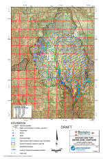
Apache Leap Tuff Water Level Contours Upper Queen Creek/Devils Canyon Study Area (Map) | Montgomery & Associates. 2011. Apache Leap Tuff Water Level Contours Upper Queen Creek/Devils Canyon Study Area (Map). March 1, 2011. Download PDF |
|
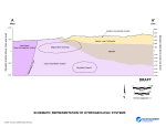
Schematic Representation of Hydrogeologic Systems (Figure) | Montgomery & Associates. 2012b. Schematic Representation of Hydrogeologic Systems (Figure). February 2012. Download PDF |
|
Results of Phase II Hydrogeologic Investigations in Support of Tailings Prefeasibility Study, Far West Site | Montgomery & Associates. 2012c. Results of Phase II Hydrogeologic Investigations in Support of Tailings Prefeasibility Study, Far West Site. July 31, 2012. Download PDF |
|
Results of Queen Creek Corridor Survey: Superior Basin, Pinal County, Arizona | Montgomery & Associates. 2013a. Results of Queen Creek Corridor Survey Superior Basin, Pinal County, Arizona. February 19, 2013. Download PDF |
|
Summary of Hydraulic Conductivity Estimates from Testing of Hydrologic Characterization Wells, 2004-2012 | Montgomery & Associates. 2014. Summary of Hydraulic Conductivity Estimates from Testing of Hydrologic Characterization Wells, 2004-2012, September 12, 2014. Download PDF |
|
Results of Hydrochemical Characterization of Groundwater Upper Queen Creek/Devils Canyon Study Area | Montgomery and Associates Inc. 2012. Results of Hydrochemical Characterization of Groundwater Upper Queen Creek/Devils Canyon Study Area: Resolution Copper Mining LLC, Pinal County, AZ. Prepared for Resolution Copper. Tucson, Arizona: Montgomery and Associates Inc. March 15. Download PDF |
|
Surface Water Baseline Report: Devils Canyon, Mineral Creek and Queen Creek Watersheds | Montgomery and Associates Inc. 2013. Surface Water Baseline Report: Devils Canyon, Mineral Creek and Queen Creek Watersheds, Resolution Copper Mining LLC, Pinal County, Arizona. Prepared for Resolution Copper. Tucson, Arizona: Montgomery and Associates Inc. May 16. Download PDF |
|
On the Cenozoic Uplift and Tectonic Stability of the Colorado Plateau | Morgan, P., and Swanberg, C.A., 1985, on the Cenozoic uplift and tectonic stability of the Colorado Plateau: Journal of Geodynamics, v. 3, p. 39-63. Download PDF |
|
Final Resolution Copper Tailings Geochemical Characterization Data Summary Report | MWH Americas Inc. 2014. Final Resolution Copper Tailings Geochemical Characterization Data Summary Report. Steamboat Springs, Colorado: MWH Americas Inc. March. Download PDF |
|
National Climatic Data Center | National Oceanic and Atmospheric Administration. 2013. National Climatic Data Center. Station Details. National Centers for Environmental Information Accessed July 23, 2013. Download PDF |
|
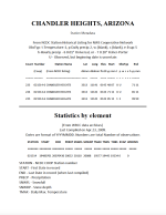
Global Historical Climatology Network, Station USC00021514 - Chandler Heights, AZ | National Oceanic and Atmospheric Administration. 2014. Global Historical Climatology Network, Station USC00021514 - Chandler Heights, AZ, US. Period of record: 1/1/1941 through 4/30/2007. Downloaded from NOAA National Climactic Data Center (Order Number 362974) on 7/10/2014. Download PDF |
|
Web Soil Survey | Natural Resources Conservation Service. 2013. Soil Survey Staff, Natural Resources Conservation Service, United States Department of Agriculture. Web Soil Survey. Available online at Web Soil Survey. Accessed 8/8/2013. Download PDF |
|
Point Precipitation Frequency Estimates from NOAA Atlas | NOAA. 2013. Point Precipitation Frequency Estimates from NOAA Atlas 14, Volume 1, Version 5. Download PDF |
|
Geochemistry of Acid Mine Waters | Nordstrom, D.K. and C.N. Alpers (1999) Geochemistry of acid mine waters. In The Environmental Geochemistry of Mineral Deposits, Reviews in Economic Geology Vol. 6A (G.S Plumlee and M.J. Logsdon, Eds.), Soc. Econ. Geol., Littleton, Colorado, p. 133-160. Download PDF |

|
Description of Input and Examples for PHREEQC Version 3 – A Computer Program for Speciation, Batch-Reaction, One-Dimensional Transport, and Inverse Geochemical Calculations | Parkhurst, D.L. and Appelo, C.A.J. (2013) Description of Input and Examples for PHREEQC Version 3 – A Computer Program for Speciation, Batch-Reaction, One-Dimensional Transport, and Inverse Geochemical Calculations. U.S. Geological Survey Techniques and Methods, Book 6, Chapter A43, 497 p, available only at PHREEQC Version 3. Download PDF |
|
Quaternary Fault Data and Map for Arizona | Pearthree, P.A. 1998. Quaternary Fault Data and Map for Arizona. Open-File Report 98-24. Tucson, Arizona: Arizona Geological Survey. Download PDF |
|
Reconnaissance Analysis of Possible Quaternary Faulting in Central Arizona | Pearthree, P.A., and Scarborough, R.B., 1984, Reconnaissance analysis of possible Quaternary faulting in central Arizona: Arizona Bureau of Geology and Mineral Technology Open-File Report 85-4, 75 p., scale 1:250,000. Download PDF |
| Geologic Map of Quaternary and Upper Tertiary Deposits, Tucson 1° x 2° Quadrangle, Arizona | Pearthree, P.A., McKittrick, M.A., Jackson, G.A., and Demsey, K.A., 1988, Geologic map of Quaternary and upper Tertiary deposits, Tucson 1° x 2° quadrangle, Arizona: Arizona Geological Survey Open-File Report 88-21, scale 1:250,000. Download PDF |
|
| Distribution, Recurrence, and Possible Tectonic Implications of Late Quaternary Faulting in Arizona | Pearthree, P.A., Menges, C.M., and Mayer, L., 1983, Distribution, recurrence, and possible tectonic implications of late Quaternary faulting in Arizona: Arizona Bureau of Geologic Mineral Technical Open-File Report 83-20, 51 p. Download PDF |
|
|
Seismic Hazard Posed by the Sugarloaf Fault, Central Arizona | Pearthree, P.A., K.R. Vincent, R. Brazier, L.D. Fellows, R.G. Davis, and O.K. Davis. 1995. Seismic Hazard Posed by the Sugarloaf Fault, Central Arizona. Open-File Report 95-7. Tucson, Arizona: Arizona Geological Survey. September. Download PDF |
|
The Mogollon Escarpment | Peirce, H.W., 1984, The Mogollon escarpment: Arizona Bureau of Geology and Mineral Technology Fieldnotes, v. 4, p. 8-11. Download PDF |
|
Documentation for the 2008 Update of the United States National Seismic Hazard Maps | Petersen, M.D., Frankel, A.D., Harmsen, S.C., Mueller, C.S., Haller, K.M., Wheeler, R.L., Wesson, R.L., Zeng, Y., Boyd, O.S., Perkins, D.M., Luco, N., Field, E.H., Wills, C.J., and Rukstales, K.S., 2008, Documentation for the 2008 update of the United States National Seismic Hazard Maps: U.S. Geological Survey Open-File Report 2008-1128, 61 p. Download PDF |
|
Geologic Map of the Superior Quadrangle, Pinal County, Arizona | Peterson, D.W. 1969. Geologic Map of the Superior Quadrangle, Pinal County, Arizona: US. Geological Survey Geologic Quadrangle Map GQ-818, 1 sheet, scale 1:24,000. Download PDF |
|
Seismotectonic Investigation for Horseshoe and Bartlett Dams, Salt River Project, Arizona | Piety, L.A. and Anderson, L.W., 1990, Seismotectonic investigation for Horseshoe and Bartlett Dams, Salt River Project, Arizona: Bureau of Reclamation Seismotectonic Report 90-7, 59 p. Download PDF |
|
The Horseshoe Fault - Evidence for Prehistoric Surface-Rupturing Earthquakes in Central Arizona | Piety, L.A. and Anderson, L.W., 1991, The Horseshoe fault--Evidence for prehistoric surface-rupturing earthquakes in central Arizona: Arizona Geology, v. 21, no. 3, p. 1, 4-8. Download PDF |
|
Code of Regulations | Pinal County Air Quality Control District. 2014. Code of Regulations. As amended July 23, 2014. Available online at Pinal County Code of Regulations Download PDF |
|
We Create Our Future: Pinal County Comprehensive Plan | Pinal County Comprehensive Plan. 2012. We Create Our Future: Pinal County Comprehensive Plan, Adopted November 18, 2009, Updated November 19, 2012. Download PDF |
|
Resolution Pre-Feasibility Activities Plan of Operations | Resolution Copper Mining. 2010. Resolution Pre-Feasibility Activities Plan of Operations (#03-12-02-006). October 1, 2010. Download PDF |
|
Resolution Copper Mining Community Working Group Meeting Summaries | Resolution Copper Mining. 2013. Resolution Copper Mining Community Working Group Meeting Summaries. June 25, 2013 through July 31, 2013. Download PDF |
|
Resolution Copper Mining Land Exchange Proposal | Resolution Copper Mining. 2015. Resolution Copper Mining, LLC Land Exchange Proposal. August 2015. Download PDF |

|
General Plan of Operations | Resolution Copper. 2016d. General Plan of Operations Resolution Copper Mining. Superior, Arizona. May 9. Download PDF - Volume 1 , Download PDF - Volume 2 , Download PDF - Volume 3 |
|
Compilation Geologic Map of the Ray-Superior area, Central Arizona | Richard, S.M. and Spencer, J.E., 1998, Compilation Geologic Map of the Ray-Superior area, Central Arizona: Arizona Geological Survey Open-file Report 98-13, 47 p. Download PDF |
|
RocLab 1.0 Tutorial Manual | Rocscience. 2007. Tutorial Manual (pages 1-1 through 1-19). Download PDF |
|
Displacement across the Cholame Segment of the San Andreas Fault between 1855 and 1893 from Cadastral Surveys | Runnerstrom, E.E., Grant, L.B., Arrowsmith, J.R., Rhodes, D.D., and Stone, E.M., 2002, Displacement across the Cholame segment of the San Andreas Fault between 1855 and 1896 from cadastral surveys: Bulletin of the Seismological Society of America: v. 92, p. 2,659- 2,669. Download PDF |
|
Earthquake Ages and Displacements, Frazier Mountain Paleoseismic Site | Scharer, K.M., Weldon, R.J., Gibson, B.C., and Streig, A.R., 2011, Earthquake ages and displacements, Frazier Mountain paleoseismic site, Abstract T51B-2324 presented at 2011 Fall Meeting, AGU, San Francisco, Calif., 5-9 Dec. Download PDF |
|
SHAKE - A Computer Program for Earthquake Response Analysis of Horizontally Layered Sites | Schnabel, P.B., Lysmer, J. and Seed, H.B., 1972, SHAKE - A computer program for earthquake analysis of horizontally layered sites, Earthquake Engineering Research Center, University of California, Berkeley, Report No. EERC 72-12. Download PDF |
|
Fault Behavior and Characteristic Earthquakes: Examples From the Wasatch and San Andreas Fault Zones | Schwartz, D.P. and Coppersmith, K.J., 1984, Fault behavior and characteristic earthquakes-- examples from the Wasatch and San Andreas fault zones: Journal of Geophysical Research, v. 89, p. 5681-5698. Download PDF |
|
Environmental and Geotechnical Characterization of Resolution Pilot Plant Tailings | SGS Mineral Services. 2014. Environmental and Geotechnical Characterization of Resolution Pilot Plant Tailings, Report to Resolution Copper Mining, Project 12074-002 – Final Report Revision 1, March 27, 2014. Download PDF |
|
Economic Geology of the White Cliffs Diatomite Deposit, Mammoth, Arizona | Shenk, J.D., 1990, Economic geology of the White Cliffs diatomite deposit, Mammoth, Arizona: Tucson, University of Arizona, unpublished M.S. thesis, 157 p. Download PDF |
|
Younger Precambrian Geology in Southern Arizona | Shride, A.F. 1967. Younger Precambrian geology in southern Arizona: US Geological Survey Professional Paper 566, 89 p. Download PDF |
|
Holocene Activity of the San Andreas Fault at Wallace Creek, California | Sieh, K.E. and Jahns, R.H., 1984, Holocene activity of the San Andreas fault at Wallace Creek, California: Geological Society of America Bulletin, v. 95, p. 883-896. Download PDF |
|
Slip Along the San Andreas Fault Associated with the Great 1857 Earthquake | Sieh, K.E., 1978, Slip along the San Andreas fault associated with the great 1857 earthquake: Bulletin of the Seismological Society of America, v. 68, p. 1421-1448. Download PDF |
|
State-of-the-Art for Assessing Earthquake Hazards in the United States | Silva, W.J. and Lee, K., 1987, WES RASCAL code for synthesizing earthquake ground motions: State-of-the-art for Assessing Earthquake Hazards in the United States, Report 24: U.S. Army Engineer Waterways Experiment Station Miscellaneous Paper S-73-1, 120 p. Download PDF |
|
Body Waves in a Layered Anelastic Solid | Silva, W.J., 1976, Body waves in a layered anelastic solid, Bulletin of the Seismological Society of America, v. 66, p. 1539-1554. Download PDF |
|
Description and Validation of the Stochastic Ground Motion Model | Silva, W.J., Abrahamson, N., Toro, G., and Costantino, C, 1996, Description and Validation of the Stochastic Ground Motion Model. El Cerrito, CA: Pacific Engineering and Analysis. Download PDF |
|
Stream Channel Offset and Abandonment and a 200-year Average Recurrence Interval of Earthquakes on the San Andreas Fault at Phelan Creeks, Carrizo Plain, California | Sims, J.D., 1994, Stream channel offset and abandonment and a 200-year average recurrence interval of earthquakes on the San Andreas fault at Phelan Creek, Carrizo Plain, California, in Prentice, C.S., Schwartz, D.P., and Yeats, R.S. (eds.), Proceedings of the workshop on paleoseismology: U.S. Geological Survey Open-File Report 94-568, p. 170-172. Download PDF |
|
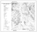
Geologic Map of the Wildcat Hill Quadrangle, Maricopa County, Arizona | Skotnicki, S.J., Leighty, R.S., and Pearthree, P.A., 1997, Geologic map of the Wildcat Hill quadrangle, Maricopa County, Arizona: Arizona Geological Survey Open-File Report 97-2, 17 p., 1 pl., scale 1:24,000. Download PDF |
|
An Overview of the Abundance, Relative Mobility, Bioavailability, and Human Toxicity of Metals | Smith, K.S. and Huyck, H.L.O. 1999. An Overview of the Abundance, Relative Mobility, Bioavailability, and Human Toxicity of Metals. In G.S. Plumlee and M.J. Logsdon (Eds.), The Environmental Chemistry of Mineral Deposits, Reviews in Economic Geology, Volume 6A, pp. 29-70. Download PDF |
|
Field and Laboratory Methods Applicable to Overburden and Mine Soils | Sobek, A., W.A. Schuller, J.R. Freeman, and R.M. Smith. 1978. Field and Laboratory Methods Applicable to Overburden and Mine Soils. EPA-600/2-78-054. Cincinnati, Ohio: Industrial Environmental Research Laboratory, Office of Research and Development, U.S. Environmental Protection Agency. March. Download PDF |
|
Geologic Map of the Mesa 30' x 60' Quadrangle, Arizona | Spencer, J.E., Richard, S.M., and Pearthree, P.A., 1998. Geologic map of the Mesa 30’x60’ quadrangle, east-central Arizona: Arizona Geological Survey Open-File Report 96-23, scale 1:100,000. Download PDF |
|
Geologic Map of the Picketpost Mountain and the Southern Part of the Iron Mountain 7 112' Quadrangles | Spencer, J.E., and S.M. Richard. 1995. Geologic Map of the Picketpost Mountain and the Southern Part of the Iron Mountain 7 1/2' Quadrangles, Pinal County, Arizona. Open-File Report 95-15. Tucson: Arizona Geological Survey. September. Download PDF |
|
Analysis of Completeness of the Earthquake Sample in the Puget Sound Area and Its Effect on Statistical Estimates of Earthquake Hazard | Stepp, J.C., 1972, Analysis of completeness of the earthquake sample in the Puget Sound area and its effect on statistical estimates of earthquake hazard: Proceedings of the International Conference on Microzonation, v. 2, 897-910. Download PDF |
|
Advances in Acid Rock Drainage (ARD) Characterization of Mine Wastes | Stewart, W.A., S.D. Miller, and R. Smart. 2006. Advances in acid rock drainage (ARD) characterization of mine wastes. Paper presented at the 7th International Conference on Acid Rock Drainage (ICARD), St. Louis, Missouri. Download PDF |
|
Recent Rupture History of the San Andreas Fault Southeast of Cholame in the Northern Carrizo Plain, California | Stone, E.M., Grant, L., and Arrowsmith, J.R., 2002, Recent rupture history of the San Andreas Fault southeast of Cholame in the northern Carrizo Plain, California: Bulletin of the Seismological Society of America, v. 92, p. 983-997. Download PDF |
|
Structural Configuration of the Otates Fault | Suter, M., 2008. Structural configuration of the Otates fault (Southern Basin and Range Province) and its rupture in the 3 May 1887 M 7.5 Sonora, Mexico, earthquake: Bulletin of the Seismological Society of America, v. 98, p. 2879-2893. Download PDF |
|
Active Tectonics of Northeastern Sonora, Mexico (Southern Basin and Range Province) and the 3 May 1887 Mw 7.4 Earthquake | Suter, M., and J. Contreras. 2002. Active tectonics of northeastern Sonora, Mexico (southern Basin and Range Province) and the 3 May 1887 MW 7.4 earthquake. Bulletin of the Seismological Society of America 92(2):581-589. Download PDF |
|
Verification of Probabilistic Seismic Hazard Analysis Computer Programs | Thomas, P.A., Wong, I.G., and Abrahamson, N., 2010, Verification of probabilistic seismic hazard analysis software programs: PEER Report 2010/106, Pacific Earthquake Engineering Research Center, College of Engineering, University of California, Berkeley, 173 p. Download PDF |
|
San Andreas Fault Zone, California: M ≥5.5 Earthquake History | Toppozada, T.R., Branum, D.M., Reichle, M.S., and Hallstrom, C.L., 2002, San Andreas fault zone, California: M ≥5.5 earthquake history: Bulletin of the Seismological Society of America, v. 92, p. 2555-2601. Download PDF |
|
Tonto National Forest Plan | U.S. Forest Service. 1985b. Tonto National Forest Land and Resource Management Plan. U.S. Forest Service, Southwestern Region. October. Download PDF |
|
Training Guide for Reclamation, Bond Estimation, and Administration | U.S. Forest Service. 2004. Training Guide for Reclamation Bond Estimation and Administration: For Mineral Plans of Operations authorized and administered under 36 CFR 228A. Washington D.C.: U.S. Forest Service. April. Download PDF |
|
Legends of the Superior Trail | U.S. Forest Service. 2013a. The Legends of Superior Trails: Pinal to the Arizona Trail. Available at: Download Legends of Superior Trails PDF. Accessed January 18, 2019. Download PDF |
|
Screening / Scoping Level Probabilistic Seismic Hazard Analyses | URS Corporation, 2002, Screening/scoping level probabilistic seismic hazard analyses for Granite Reef Diversion and Theodore Roosevelt Dams, Salt River Project: unpublished report prepared for the U.S. Bureau of Reclamation. Download PDF |
|
Site-Specific Seismic Hazard Evaluation of the Lake Roberts Dam, New Mexico | URS Corporation, 2011, Site-specific seismic hazard evaluation of the Lake Roberts Dam, New Mexico: unpublished report prepared for U.S. Fish and Wildlife Service. Download PDF |
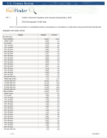
|
County Data for Gila and Pinal Counties, Arizona | US Census Bureau. 2010. American Fact Finder. DP-1. Profile and General Population and Housing Characteristics 2010. County Data for Gila and Pinal counties, Arizona. Available at US Census Bureau Census Data. Accessed April 10, 2012. Download PDF |
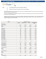
|
Community Data for Bylas, Claypool, Globe, Hayden, Kearny, Miami, Peridot, San Carlos, Superior, and Winkelman, Arizona | US Census Bureau. 2011. American Fact Finder. DP05. ACS Demographic and Housing Estimates 2007 – 2001 American Community Survey 5-Year Estimates. Community Data for Bylas, Claypool, Globe, Hayden, Kearny, Miami, Peridot, San Carlos, Superior, and Winkelman, Arizona. Available at US Census Bureau Census Data. Accessed October 30, 2013. Download PDF |
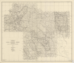
|
Arizona, Gila and Salt River Meridian Map | USDA Forest Service. 1930. Crook National Forest. Arizona, Gila and Salt River Meridian Map (on file, Arizona Historical Society, Tucson). Download PDF |
|
National Forest Management Act Planning Rule | USDA Forest Service. 1982. National Forest Management Act Planning Rule. Available online at: National Forest System Land and Resource Management Planning (Accessed August 4, 2014). Download PDF |
|
FSM 2800 – Minerals and Geology | USDA Forest Service. 1990. FSM 2800 – Minerals and Geology, Chapter 2840 Reclamation. Amendment 2800-90-1. June 1, 1990. Download PDF |
|
Habitat Planning and Evaluation | USDA Forest Service. 1991. FSM 2600 – Wildlife, Fish, and Sensitive Plant Habitat Management, Chapter 2620 – Habitat Planning and Evaluation. Amendment No. 26000-91-5. July 19, 1991. Download PDF |
|
Road Management Policy | USDA Forest Service. 2001. Road Management Policy. January 2001. Download PDF |
|
Threatened, Endangered and Sensitive Plants and Animals | USDA Forest Service. 2005. FSM 2600 – Wildlife, Fish, and Sensitive Plant Habitat Management, Chapter 2670 Threatened, Endangered and Sensitive Plants and Animals. Amendment 2600-2005-1. September 23, 2005. Download PDF |
|
Special Use Permit Authority: Federal Land Policy and Management Act | USDA Forest Service. 2008. Special Use Permit Authority: Federal Land Policy and Management Act, as Amended October 21, 1976. Executed October 29, 2008, expires October 31, 2018. Download PDF |
|
Noxious Weed Management | USDA Forest Service. 2009. FSM 2000 – National Forest Resource Management, Chapter 2080 Noxious Weed Management. Amendment 2000-2009-1. April 3, 2009. Download PDF |
|
Environmental Impact Statement Tonto National Forest Plan | USDA Forest Service. Tonto National Forest. 1985a. Environmental Impact Statement Tonto National Forest Plan, Forest Services, Southwestern Region. October 1985. Download PDF |
|
Tonto National Forest Sensitive Species List | USDA Forest Service. Tonto National Forest. 2011. Tonto National Forest Sensitive Species List. US Forest Service, Tonto National Forest. Phoenix, Arizona. Accessed October 21, 2013. Download PDF |
|
Tonto National Forest Management Indicator Species | USDA Forest Service. Tonto National Forest. 2012. Tonto National Forest Management Indicator Species. October 2012. Download PDF |
|
Oak Flat | USDA Forest Service. Tonto National Forest. 2014. Tonto National Forest. Oak Flat. Available at: Oak Flat Campground. Accessed August 27, 2014. Download PDF |
|
Map of Gila and Salt River Base Line | Vander Meer, T., 1927. Gila and Salt River Base Line. General Land Office, Department of the Interior. Download PDF |
|
Kinetic Testing Results of Cleaner and Scavenger Tailings – Resolution Copper Project | Verberg, R., and M. Harvey. 2008. Kinetic Testing Results of Cleaner and Scavenger Tailings - Resolution Copper Project. Ref: 073-92548. Technical memorandum. Redmond, Washington: Golder Associates Inc. July 14. Download PDF |
|
The History of Mining at Superior | Walker, Gladys and T.G. Chilton. 1991. The History of Mining at Superior, History of Mining in Arizona, vol. II, 231-36, edited by J. Michael Cantly and Michael N. Greely. Mining Club of the Southwest Foundation, Tucson. Download PDF |
|
Estimation of the Earthquake Recurrence Parameters for Unequal Observation Periods for Different Magnitudes | Weichert, D.H., 1980, Estimation of the earthquake recurrence parameters for unequal observation periods for different magnitudes: Bulletin of the Seismological Society of America, v. 70, p. 1337-1346. Download PDF |
|
New Empirical Relationships among Magnitude, Rupture Length, Rupture Width, Rupture Area, and Surface Displacement | Wells, D.L. and Coppersmith, K.J., 1994, New empirical relationships among magnitude, rupture length, rupture width, rupture area, and surface displacement: Bulletin of the Seismological Society of America, v. 84, p. 974-1002. Download PDF |
|
Earthquakes, Quaternary Faults, and Seismic Hazard in California | Wesnousky, S.G., 1986, Earthquakes, Quaternary faults, and seismic hazard in California: Journal Geophysical Research, v. 91, p. 12,587-12,631. Download PDF |
|
Climate Narratives of the State - Arizona | Western Regional Climate Center (WRCC). 2012. Climate Narratives of the State - Arizona. Climate of Arizona. Accessed on 5/2/2012. Download PDF |
|
Western US Climate Historical Summaries | Western Regional Climate Center. 2013. Western US Climate Historical Summaries. Western U.S. Climate Historical Summaries. Accessed July 22, 2013. Download PDF |
|
Baseline Biology and Land Use Report | WestLand Resources Inc. 2004. Baseline Biology and Land Use Report. 2004. Prepared for Resolution Copper Mining. Download PDF |
|
2004 Reptile and Amphibian Survey, Federal Parcel, Pinal County, Arizona | WestLand Resources Inc. 2004a. 2004 Reptile and Amphibian Survey Federal Parcel, Pinal County, Arizona. Prepared for Resolution Copper Mining. December 2004. Download PDF |
|
Federal Lands Biological Assessment and Evaluation | WestLand Resources Inc. 2008. Federal Lands Biological Assessment and Evaluation. Resolution Copper Mining Water Pipeline Project. Prepared for Resolution Copper Mining. June 23, 2008. Download PDF |
|
Jurisdictional Waters Determination for the Resolution West Plant and East Plant Analysis Areas, Pinal County, Arizona | Westland Resources Inc. 2011. Jurisdictional Waters Determination for the Resolution West Plant and East Plant Analysis Areas, Pinal County, Arizona. Prepared for US Army Corps of Engineers. July 28, 2011. Download PDF |
|
Amphibian and Reptile Surveys | WestLand Resources Inc. 2012a. Amphibian and Reptile Surveys. Prepared for Resolution Copper Mining. December 12, 2012. Download PDF |
|
Vegetation and Wildlife Assessment of the Mineral Creek Study Area | Westland Resources Inc. 2012b. Vegetation and Wildlife Assessment of the Mineral Creek Study Area. Prepared for Resolution Copper Mining. September 2012. Download PDF |
|
Aquatic Resource Studies in the Resolution Study Area | WestLand Resources Inc. 2012c. Aquatic Resource Studies in the Resolution Study Area. Prepared for Resolution Copper Mining. September 2012. Download PDF |
|
Biological Evaluation of the Near West Analysis Area | WestLand Resources Inc. 2013. Biological Evaluation of the Near West Analysis Area. March 2013. Download PDF |
|
Jurisdictional Waters Determination for the Parcel 210-34-022A Analysis Area, Pinal County, Arizona | WestLand Resources Inc. 2013a. Jurisdictional Waters Determination for the Parcel 210-34-022A Analysis Area, Pinal County, Arizona. Prepared for US Army Corps of Engineers. January 10, 2013. Download PDF |
|
2012 Springsnail Survey Devils Canyon, Pinal County, Arizona | WestLand Resources Inc. 2013b. 2012 Springsnail Survey Devils Canyon, Pinal County, Arizona. Prepared for Resolution Copper Mining. March 15, 2013. Download PDF |
|
Jurisdictional Waters Determination for the Near West Analysis Area, Pinal County, Arizona | WestLand Resources Inc. 2014. Jurisdictional Waters Determination for the Near West Analysis Area, Pinal County, Arizona. Prepared for US Army Corps of Engineers. January 24, 2014. Download PDF |
|
Biological Evaluation, Baseline Hydrologic & Geotechnical Data Gathering Activities on Tonto National Forest | WestLand Resources Inc. 2014a. Biological Evaluation, Baseline Hydrologic & Geotechnical Data Gathering Activities on Tonto National Forest. Prepared for Resolution Copper Mining. Download PDF |
|
Site-Specific Seismic Hazard Analyses for Miami Tailing Dams, Claypool, Arizona | Wong, I., Pezzopane, S., and Dober, M., 2008, Site-specific seismic hazard analyses for Miami Tailing Dams, Claypool, Arizona: unpublished report prepared for Freeport-McMoran Copper and Gold Miami Operations. Download PDF |
|
Site-Specific Seismic Hazard Evaluation of the Morenci Mine Tailing Dam, Arizona | Wong, I., Terra, F., Olig, S., and Dober, M., 2011, Site-specific seismic hazard evaluation of the Morenci Mine Tailing Dam, Arizona: unpublished report prepared for Freeport-McMoran Copper and Gold Inc. Download PDF |
|
Site-Specific Probabilistic and Deterministic Seismic Hazard Analyses for Sierrita Tailing Dam, Green Valley, Arizona | Wong, I., P. Thomas, S. Olig, and F. Terra. 2008. Site-Specific Probabilistic and Deterministic Seismic Hazard Analyses: Sierrita Tailing Dam Green Valley, Arizona. Prepared for Phelps Dodge Sierrita Inc. Oakland, California: URS Corporation. October 31. Download PDF |
|
Contemporary Seismicity, Faulting, and the State of Stress in the Colorado Plateau | Wong, I.G. and Humphrey, J.R., 1989, Contemporary seismicity, faulting, and the state of stress in the Colorado Plateau: Geological Society of America Bulletin, v. 101, p. 1127-1146. Download PDF |
|
Site-Specific Probabilistic Seismic Hazard Analyses for the Idaho National Engineering Laboratory | Woodward-Clyde Federal Services, Geomatrix Consultants, and Pacific Engineering and Analysis, 1996, Site specific probabilistic seismic hazard analysis for the Idaho National Engineering Laboratory: Final Report prepared for Lockheed Martin Idaho Technologies and U.S. Department of Energy, INEL-95/0536, Volumes 1 and 2. Download PDF |
|
Seismic Hazards in Southern Califomia: Probable Earthquakes, 1994 to 2024 | WGCEP (Working Group on California Earthquake Predictions), 1995, Seismic hazards in southern California: probable earthquakes, 1994 to 2024: Bulletin of the Seismological Society of America, v. 95, p. 379-439. Download PDF |
|
Probabilities of Large Earthquakes Occurring in California on the San Andreas Fault | WGCEP (Working Group on California Earthquake Probabilities), 1988, Probabilities of large earthquakes occurring in California on the San Andreas fault: U.S. Geological Survey Open- File Report 88-398, 62 p. Download PDF |
|
The Uniform California Earthquake Rupture Forecast, Version 2 (UCERF 2) | WGCEP (Working Group on California Earthquake Probabilities), 2008, The Uniform California Earthquake Rupture Forecast, Version 2 (UCERF 2), USGS Open-File Report 2007- 1437/CGS Special Report 203/SCEC Contribution #1138, Version 1.0. Download PDF |
|
Reference Evapotranspiration Estimates for Arizona | Yitayew, M. 1990. Reference Evapotranspiration Estimates for Arizona. Department of Agriculture and Biosystems Engineering. Technical Bulletin. University of Arizona, Agricultural Experiment Station, Tucson, Arizona. Download PDF |
|
Three-Dimensional Excavation and Recent Rupture History along the Cholame Segment of the San Andreas Fault | Young, J.J., Arrowsmith, JR., Colini, L., Grant, L.B., and Gootee, B., 2002, 3-D excavation and measurement of recent rupture history along the Cholame segment of the San Andreas Fault: Bulletin of the Seismological Society of America, v. 92, p. 2,670-2,688. Download PDF |
|
Implications of Fault Slip Rates and Earthquake Recurrence Models to Probabilistic Seismic Hazard Estimates | Youngs, R.R. and Coppersmith, K.J., 1985, Implications of fault slip rates and earthquake recurrence models to probabilistic seismic hazard estimates: Bulletin of the Seismological Society of America, v. 75, p. 939-964. Download PDF |
|
Assessment of Regional Earthquake Hazards and Risk Along the Wasatch Front, Utah | Youngs, R.R., Swan, F.H., Power, M.S., Schwartz, D.P., and Green, R.K., 2000, Probabilistic analysis of earthquake ground shaking hazard along the Wasatch Front, Utah, in P.L. Gori and W.W. Hays (eds.), Assessment of Regional Earthquake Hazards and Risk Along the Wasatch Front, Utah: U.S. Geological Survey Professional Paper 1500-K-R, p. M1-M74. Download PDF |
|
Slip in the 1857 and Earlier Large Earthquakes Along the Carrizo Plain, San Andreas Fault | Zielke, O., Arrowsmith, J R., Ludwig L G., Akciz, S.O., 2010, Slip in the 1857 and Earlier Large Earthquakes Along the Carrizo Plain, San Andreas Fault: Science, v. 327, 5969, p. 1119-1122. Download PDF |

