Date Published
May 1996
Summary
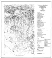
The study area is situated along the southern edge of the Superstition Mountains approximately 40 miles east of the greater Phoenix metropolitan area (Figure 1). Geology is dominated by mid-Tertiary volcanic rocks of the Superior volcanic field (Ransome, 1903), and these rocks depostionally overlie a crystalline basement of early Proterozoic Pinal Schist intruded by middle Proterozoic granitoids. In some areas a relatively thin sequence of the Middle Proterozoic Apache Group occurs along the contact between these two rock types.
Cited In
Reference Information
Ferguson, C.A., and S.J. Skotnicki. 1996. Geologic Map of the Florence Junction and Southern Portion of the Weavers Needle 7.5' Quadrangles, Pinal County, Arizona. Tucson: Arizona Geological Survey.


