Documents Cited - Land Exchange
|
Reserving Lands within National Forests for Use of the Forest Service as Camp Grounds, Recreation Areas, or for Other Public Purposes | Andahl, Fred G. 1955. "Reserving Lands within National Forests for Use of the Forest Service as Camp Grounds, Recreation Areas, or for other Public Purposes.” Public Land Order 1229 – Arizona. F.R. Doc 55-7926. September 27, 1955. Download PDF |
|
Ambient Groundwater Quality of the Lower San Pedro Basin: A 2000 Baseline Study | Arizona Department of Environmental Quality. 2002. Ambient Groundwater Quality of the Lower San Pedro Basin: A 2000 Baseline Study. Download PDF |
|
Arizona State Implementation Plan, Regional Haze Under 308 of the Federal Regional Haze Rule | Arizona Department of Environmental Quality. 2011. Arizona State Implementation Plan (SIP). Regional Haze Under 308 of the Federal Regional Haze Rule. Air Quality Division. January 2011. Download PDF |
|
2010 Status of Water Quality Arizona’s Integrated 305(b) Assessment and 303(d) Listing Report | Arizona Department of Environmental Quality. 2012. 2010 Status of Water Quality. Arizona’s Integrated 305(b) Assessment and 303(d) Listing Report. June 2012. Available at: 2010 Water Quality Report. Accessed July 30, 2012. Download PDF |
|
Map of Nonattainment, Attainment Areas, and Maintenance Areas | Arizona Department of Environmental Quality. 2013. E-Maps. Map of Nonattainment, Attainment Areas, and Maintenance Areas. ADEQ: eMaps. Accessed July 25, 2013. Download PDF |
|
2012/2014 Status of Water Quality Arizona’s Integrated 305(b) Assessment and 303(d) Listing Report | Arizona Department of Environmental Quality. 2015a. 2012/2014 Draft Status of Water Quality Arizona’s Integrated 305(b) Assessment and 303(d) Listing Report. January 2015. Download PDF |
|
ADWR GIS Data and Maps | Arizona Department of Water Resources. 2013. Well Registry (Wells55). ADWR GIS Data & Maps. Online data retrieved and downloaded from ADWR GIS Data and Maps. Accessed March 2, 2013. Download PDF |
|
Groundwater Hydrology of the Salt River Basin | Arizona Department of Water Resources. 2015a. Groundwater Hydrology of the Salt River Basin. Online data retrieved at [Link Outdated]. Accessed March 12, 2015. |
|
Groundwater Hydrology of the Verde River Basin | Arizona Department of Water Resources. 2015b. Groundwater Hydrology of the Verde River Basin. Online data retrieved at [Link Outdated]. Accessed March 12, 2015. |
|
Phoenix AMA Groundwater Conditions | Arizona Department of Water Resources. 2015c. Phoenix AMA Groundwater Conditions. Online data retrieved at [Link Outdated]. Accessed March 12, 2015. |
|
Groundwater Conditions in the Little Colorado River Plateau Basin | Arizona Department of Water Resources. 2015d. Groundwater Conditions in the Little Colorado River Plateau Basin. Online data retrieved at [Link Outdated]. Accessed March 12, 2015. |
|
Groundwater Conditions in the Upper San Pedro Basin | Arizona Department of Water Resources. 2015e. Groundwater Conditions in the Upper San Pedro Basin. Online data retrieved at [Link Outdated]. Accessed March 12, 2015. |
|
Online Query of Surface Water Rights | Arizona Department of Water Resources. 2015f. Online query of surface water rights. Online data retrieved at [Link Outdated]. Accessed February 25, 2015. |
|
Game Management Units | Arizona Game & Fish Department. 2015a. GIS Program, 20110101, Game Management Units: Hunting and Trapping Regulations 2010-2011, Arizona Game and Fish Department, Phoenix, AZ. Online data retrieved at Game Management Units. Accessed on May 25, 2015. Download PDF |
|
Forest Service Grazing Allotments, General Resource Areas and Wild Horse & Burro Territories in Arizona | Arizona Game & Fish Department. 2015b. AGFD 20110922, Forest Service Grazing Allotments, General Resource Areas and Wild Horse & Burro Territories in Arizona: Arizona Game and Fish Department, Phoenix, AZ. Online data retrieved at Forest Service Grazing Allotments. Accessed May 25, 2015. Download PDF |
|
Regional Soils | Arizona Land Resource Information System. 1975. Regional Soils: GIS Cover. Available at: [Link Outdated]. Accessed March 13, 2015. |
|
Mammals of the Research Ranch | Audubon Society. 2007. Mammals of the Research Ranch. National Audubon Society. November 11, 2007. Download PDF |

|
Bird Checklist | Audubon Society. 2014. Appleton-Whitsell Research Ranch of the National Audubon Society. Revised June 2014. Download PDF |
|
Tertiary Extension and Fault-Block Rotation in the Transition Zone, Cedar Mountains Area, Arizona | Brand, P.K., and Stump, E. 2005. Tertiary Extension and Fault-Block Rotation in the Transition Zone, Cedar Mountains Area, Arizona v. 1.1: Arizona Geological Survey Contributed Map CM-11-A. Download PDF |
|
Biotic Communities – Southwestern United States and Northwestern Mexico | Brown, D. E., and C. Lowe. 1980. Biotic Communities – Southwestern United States and Northwestern Mexico [Map]. General Technical Report RM-78, Rocky Mountain Forest and Range Experiment Station, Forest Service, U. S. Department of Agriculture. Reprinted 1994 by University of Utah Press, Salt Lake City, Utah. Download PDF |
|
Biotic Communities of the American Southwest - United States and Mexico | Brown, D.E. (ed). 1982. Biotic Communities of the American Southwest - United States and Mexico. Desert Plants 4(1-4):1-342. Special Issue. The University of Arizona. Tucson. Download PDF |
|
Biotic Communities: Southwestern United States and Northwestern Mexico | Brown, D.E. (ed.). 1994. Biotic Communities: Southwestern United States and Northwestern Mexico. Salt Lake City, Utah: University of Utah Press. Download PDF |
|
A Cultural Resources Inventory of the Magma Arizona Railroad Right-of-Way, Pinal County, Arizona | Buckles, A., C. Jerla, and C. Dore. 2012. A Cultural Resources Inventory of the Magma Arizona Railroad Right-of-Way, Pinal County, Arizona. Cultural Resources Report 2012-18. ASM Accession No. 2012-0122. WestLand Project No. 807.44 C 500. Tucson, Arizona: WestLand Resources, Inc. May 15. Download PDF |
|
Geometry, Structure, and Concealed Lithology of the San Rafael Basin, Southeastern Arizona | Bultman, Mark W. 1999. Geometry, Structure, and Concealed Lithology of the San Rafael Basin, Southeastern Arizona. USGS Open-File Report 99-399. Geometry, Structure, and Concealed Lithology. Download PDF |
|
Manual 8431 - Visual Resource Contrast Rating | Bureau of Land Management. 1986a. Manual 8431 - Visual Resource Contrast Rating. Rel. 8-30. Washington D.C.: Bureau of Land Management. January 17. Download PDF |
|
Mineral Reports - Preparation and Review | Bureau of Land Management. 1994. BLM Manual MS-3060 Mineral Reports - Preparation and Review. Rel. 3-284. Updated April 7, 1994. Washington, D.C. Download PDF |

|
Bureau of Land Management Exchange Handbook | Bureau of Land Management. 2005. Bureau of Land Management Land Exchange Handbook, H 2200-1 (Public). Updated December 16, 2005. Washington D.C. Download PDF |
|
Compiled using EPS-HDT | Bureau of Land Management. 2009. Washington, D.C., Compiled using EPS-HDT; Headwaters Economics. March 18, 2015. Download PDF |
|
Land and Mineral Legacy Rehost 2000 System—LR2000 | Bureau of Land Management. 2015a. Land and Mineral Legacy Rehost 2000 System—LR2000. Online data retrieved at Land and Mineral System Reports. Accessed March 11, 2015. Download PDF |
|
Rangeland Administration System | Bureau of Land Management. 2015b. Rangeland Administration System. Online data retrieved at Rangeland Administration System Reports. Accessed March 10, 2015. Download PDF |
|
Roadside Geology of Arizona | Chronic, Halka. 1983. Roadside Geology of Arizona. Mountain Press Publishing Co. Missoula. Download PDF |
|
Migrants and Mounds: Classic Period Archaeology of the Lower San Pedro River Valley | Clark, Jeffry J. and Patrick D. Lyons. 2012. Migrants and Mounds: Classic Period Archaeology of the Lower San Pedro River Valley. Anthropological Papers No. 45. Archaeology Southwest, Tucson, Arizona. Download PDF |
|
Herpetofauna of the Appleton-Whittell Research Ranch | Cogan, R.C. 2012. Herpetofauna of the Appleton-Whittell Research Ranch. Elgin, Arizona: National Audubon Society. November. Download PDF |
|
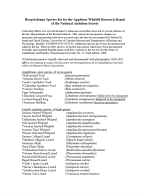
Herpetofauna Species List for the Appleton-Whittell Research Ranch of the National Audubon Society | Cogan, Roger C. 2011. Herpetofauna Species list for the Appleton-Whittell Research Ranch of the National Audubon Society. July 2011. Download PDF |
|
A History of the Lands in the National Audubon Society's Research Ranch, Near Elgin, in Santa Cruz County, Arizona | Collins, Glendon E. 2008. A History of the Lands in the National Audubon Society’s Research Ranch near Elgin, in Santa Cruz County, Arizona. Appleton-Whittel Research Ranch. June 2008. Download PDF |
|
Environmental Justice: Guidance under the National Environmental Policy Act | Council on Environmental Quality. 1997. Environmental Justice: Guidance under the National Environmental Policy Act. Washington, D.C. December 10. Download PDF |
|
The Resolution Project: Reconnaissance and Evaluation of Archaeological Resources in the Oak Flat Area | Deaver, William L. 2013. The Resolution Project: Reconnaissance and Evaluation of Archaeological Resources in the Oak Flat Area. Cultural Resources Report No. 2012-11. February 18, 2013. Download PDF |

|
FEMA Flood Hazard Zones | Federal Emergency Management Agency. 2015. FEMA Flood Hazard Zones. Available at: FEMA Flood Map Service Center. Accessed Q1 2015. Download PDF |
|
Geologic Map of the Florence Junction and Southern Portion of the Weavers Needle 7.5' Quadrangles, Pinal County, Arizona | Ferguson, C.A., and S.J. Skotnicki. 1996. Geologic Map of the Florence Junction and Southern Portion of the Weavers Needle 7.5' Quadrangles, Pinal County, Arizona. Tucson: Arizona Geological Survey. Download PDF |
|
Phase I Environmental Site Assessment Forested Land | Golder Associates, Inc. 2005. Phase I Environmental Site Assessment Forested Land T14N, R12E, Section 9 Coconino County, Arizona Submitted to The Trust for Public Land Western Region - Southwest Office. May 23, 2005. Download PDF |
|
An Archaeological Survey of the Transamerica Land Exchange A-7877 Apache Sitgreaves, Coconino, and Tonto National Forests, Arizona | Green, Dee F. 1974. An Archaeological Survey of the Transamerica Land Exchange A-7877 Apache Sitgreaves, Coconino, and Tonto National Forests, Arizona. United States Forest Service Southwestern Region. June 1974. Download PDF |
|
Some Geologic Features of the Superior Area, Pinal County, Arizona | Hammer, D.H. and Webster, R.N. 1962. Some geologic features of the Superior area, Pinal County, Arizona, in Weber, R.H. and Peirce, H.W. (eds). 13th Annual Fall Field Conference Guidebook: New Mexico Geological Society, Mogollon Rim Region (East-Central Arizona). Download PDF |
|
A Profile of Demographics | Headwaters Economics. 2015. A Profile of Demographics. Complied Data Using Economic Profile System- Human Dimensions Toolkit (EPS-HDT). March 18, 2015. Download PDF |
|
Geology and Exploration Progress at the Resolution Porphyry Cu-Mo Deposit, Arizona | Hehnke, C., G. Ballantyne, H. Martin, W. Hart, A. Schwarz, and H. Stein. 2012. Geology and exploration progress at the Resolution porphyry Cu-Mo deposit, Arizona. Society of Economic Geologists, Inc.(Special Publication 16):147-166. Download PDF |
|
Arizona Soils | Hendricks, David M. Arizona Soils. Tucson, AZ: College of Agriculture, University of Arizona, 1985. Print. Download PDF |
|
Kennecott Drilling Exploration #2 | Herkenhoff, Ryan. 1995. Kennecott Drilling Exploration #2. United States Forest Service Report Number 95 12 126. September 28, 1995. Download PDF |
|
The Resolution Project: Results of an Archaeological Survey in Pinal County, Arizona | Lindeman, M.W., and G.J. Whitney. 2005. The Resolution Project: Results of an Archaeological Survey in Pinal County, Arizona. Technical Report No. 2003-10. Tucson, Arizona: Desert Archaeology, Inc. September. Download PDF |
|
CorridorDesigner: ArcGIS Tools for Designing and Evaluating Corridors | Majka, D., J. Jenness, and P. Beier. 2007. CorridorDesigner: ArcGIS tools for designing and evaluating corridors. Online data retrieved at Corridor Design on March 10, 2015. Download PDF |
|
Flora of the Appleton-Whittell Research Ranch, Northeastern Santa Cruz County, Arizona | McLaughlin, S.P., E.L. Geiger, and J.E. Bowers. 2001. Flora of the Appleton-Whittell Research Ranch, northeastern Santa Cruz County, Arizona. Journal of the Arizona-Nevada Academy of Science 33(2):113-131. Download PDF |
|
National Climatic Data Center | National Oceanic and Atmospheric Administration. 2013. National Climatic Data Center. Station Details. National Centers for Environmental Information Accessed July 23, 2013. Download PDF |
|
Geology of Arizona | Nations, D. and Stump, E. 1996. Geology of Arizona. Second Edition. Kendall/Hunt Publishing Co., Dubuque, Iowa. Download PDF |
|
Management Plan for the 7B Ranch - 2010 | Nature Conservancy in Arizona. 2010. Management Plan for the 7B Ranch. December 2010. Download PDF |
| Revisions to the Standards for the Classification of Federal Data on Race and Ethnicity | Office of Management and Budget. 1997. Revisions to the Standards for the Classification of Federal Data on Race and Ethnicity. Federal Register, Vol 62, No. 210, October 30, 1997. Download PDF |
|
|
Special Warranty Deed | Pinal County Recorder’s Office. 2005. Special Warranty Deed. Certified Copy. Download PDF |
|
Resolution Pre-Feasibility Activities Plan of Operations | Resolution Copper Mining. 2010. Resolution Pre-Feasibility Activities Plan of Operations (#03-12-02-006). October 1, 2010. Download PDF |

|
General Plan of Operations | Resolution Copper. 2016d. General Plan of Operations Resolution Copper Mining. Superior, Arizona. May 9. Download PDF - Volume 1 , Download PDF - Volume 2 , Download PDF - Volume 3 |
| Geologic Map of Arizona: Arizona Geological Survey Digital Geologic Map DGM-17 | Richard, S.M., Reynolds, S.J., Spencer, J.E., and Pearthree, P.A., 2000. Geologic map of Arizona: Arizona Geological Survey Digital Geologic Map DGM-17, scale 1:1,000,000, with 5 p. text. |
|
|
Web Soil Survey | Soil Survey Staff. 2015. Natural Resources Conservation Service, United States Department of Agriculture. Web Soil Survey. Online data retrieved at Web Soil Survey. Accessed March 11, 2015. Download PDF |
|
Geologic Map of the Picketpost Mountain and the Southern Part of the Iron Mountain 7 112' Quadrangles | Spencer, J.E., and S.M. Richard. 1995. Geologic Map of the Picketpost Mountain and the Southern Part of the Iron Mountain 7 1/2' Quadrangles, Pinal County, Arizona. Open-File Report 95-15. Tucson: Arizona Geological Survey. September. Download PDF |
|
Geologic Map of the Copper Mountain Quadrangle, Gila County, Arizona | Stotnicki, Stephen J. 1999. Geologic Map of the Copper Mountain Quadrangle, Gila County, Arizona, Open-File Report 99-24. Arizona Geological Society. October 1999. Download PDF |
|
Tonto National Forest Plan | U.S. Forest Service. 1985b. Tonto National Forest Land and Resource Management Plan. U.S. Forest Service, Southwestern Region. October. Download PDF |
|
Overview of Race and Hispanic Origin | US Census Bureau. 2001. Overview of Race and Hispanic Origin. Online data retrieved at Download Overview of Race and Hispanic Origin PDF. Accessed March 10, 2015. Download PDF |
|
Census 2010 Multiple Tables; Generated Using EPS-HDT | US Census Bureau. 2010. Census 2010 multiple tables; generated using EPS-HDT; Headwaters Economics. March 18, 2015. Download PDF |
|
Measuring America: How Census Measures Poverty | US Census Bureau. 2012. Measuring America: How Census Measures Poverty. Online data retrieved at How the Census Bureau Measures Poverty. Accessed March 18, 2015. Download PDF |
|
Compiled using EPS-HDT | US Census Bureau. 2014. Governments Division, Washington, D.C., Compiled using EPS-HDT; Headwaters Economics. March 18, 2015. Download PDF |
|
American Community Survey 5-Year Estimates | US Census Bureau. 2015. American Community Survey 5-Year Estimates, multiple tables. Generated using EPS-HDT; Headwaters Economics. March 18, 2015. Download PDF |
|
Payments in Lieu of Taxes (PILT) | US Department of Interior. Payments in Lieu of Taxes (PILT). 2009. Washington D.C., Compiled using EPS-HDT; Headwaters Economics. March 18, 2015. Download PDF |
|
Final Guidance for Incorporating Environmental Justice Concerns in EPA's NEPA Compliance Analyses | US Environmental Protection Agency. 1998. Final Guidance for Incorporating Environmental Justice Concerns in EPA's NEPA Compliance Analyses. April 1998. Download PDF |
|
Compiled using EPS-HDT | US Fish and Wildlife Service. 2007. Washington, D.C., Compiled using EPS-HDT; Headwaters Economics. March 18, 2015. Download PDF |
|
National Wetland Inventory | US Fish and Wildlife Service. 2015. National Wetland Inventory. Digital Data. Online data retrieved at Wetlands Mapper. Accessed March 12, 2015. Download PDF |
|
Protected Areas Database of the United States | US Geological Survey. 2012. Protected Areas Database of the United States version 1.3. Gap Analysis Program. Compiled using EPS-HDT; Headwaters Economics. March 18, 2015. Download PDF |
|
Compiled using EPS-HDT | US Office of Natural Resources Revenue (ONRR). 2012. Washington, D.C., Compiled using EPS-HDT; Headwaters Economics. March 18, 2015. Download PDF |
|
US Forest Service Manual on Land Ownership and Exchanges | USDA Forest Service. 2003a. US Forest Service Manual on Land Ownership and Exchanges. FSM 5400 Land Ownership, Chapter 5430 Exchanges, Amendment No. 5400-2003-2. Washington D.C. Download PDF |
|
Recreation, Wilderness, and Related Resource Management | USDA Forest Service. 2003b. Forest Service Manual 2300 Recreation, Wilderness, and Related Resource Management, Chapter 2830 Landscape Management Download PDF |
|
US Forest Service Land Acquisition Handbook | USDA Forest Service. 2004. US Forest Service Land Acquisition Handbook. FSH 5409.13 Land Acquisition Handbook, Chapter 30 Land Exchange, Amendment No. 5409.13-2004-1. Washington D.C. Download PDF |
|
Compiled using EPS-HDT | USDA Forest Service. 2009. Washington, D.C. Compiled using EPS-HDT; Headwaters Economics. March 18, 2015. Download PDF |
|
Coconino National Forest Land and Resource Management Plan | USDA Forest Service. Coconino National Forest. 1987. Coconino National Forest Land and Resource Management Plan Southwestern Region. August 1987. Download PDF |
|
Environmental Impact Statement Tonto National Forest Plan | USDA Forest Service. Tonto National Forest. 1985a. Environmental Impact Statement Tonto National Forest Plan, Forest Services, Southwestern Region. October 1985. Download PDF |
|
Western US Climatological Summaries | Western Regional Climate Center. 2015. Western US Climatological Summaries. Online data retrieved at Climate Historical Summaries. Accessed April 1, 2015. Download PDF |
|
Phase I Environmental Site Assessment 3,500-Acre San Pedro River Site Pinal County, Arizona | WestLand Resources Inc. 2003b. Phase I Environmental Site Assessment 3,500-Acre San Pedro River Site Pinal County, Arizona. Prepared for Resolution Copper Company. July 2003. Download PDF |
|
Ecological Overview Summary: Federal Parcel and Offered Lands Parcels | WestLand Resources Inc. 2004b. Ecological Overview Summary: Federal Parcel and Offered Lands Parcels. Prepared for Resolution Copper Company. November, 2004. Download PDF |
|
Phase I Environmental Site Assessment 6L Ranch Site, Maricopa County, Arizona | WestLand Resources Inc. 2004e. Phase I Environmental Site Assessment 6L Ranch Site, Maricopa County, Arizona. Prepared for Swift Land & Cattle Company, LLC. April 6, 2004. Download PDF |
|
Phase I Environmental Site Assessment Appleton Ranch, Site Santa Cruz County, Arizona | WestLand Resources Inc. 2004f. Phase I Environmental Site Assessment Appleton Ranch, Site Santa Cruz County, Arizona. Prepared for Swift Land & Cattle Company, LLC. March 22, 2004. Download PDF |
|
Phase I Environmental Site Assessment JX Ranch Site, Gila County, Arizona | WestLand Resources Inc. 2004g. Phase I Environmental Site Assessment JX Ranch Site, Gila County, Arizona. Prepared for Resolution Copper Mining. March 2004. Download PDF |
|
Phase I Environmental Site Assessment LX Ranch Site, Yavapai County, Arizona | WestLand Resources Inc. 2004h. Phase I Environmental Site Assessment LX Ranch Site, Yavapai County, Arizona. Prepared for Swift Land & Cattle Company, LLC. March 10, 2004. Download PDF |
|
Wetlands and Floodplains Report | WestLand Resources Inc. 2004i. Wetlands and Floodplains Report. Prepared for Resolution Copper Company. October 2004. Download PDF |
|
A Preliminary Assessment of Cultural Resources in the Tam O'Shanter Area Preliminary Roadway Assessment | WestLand Resources Inc. 2006. A Preliminary Assessment of Cultural Resources in the Tam O'Shanter Area Preliminary Roadway Assessment. Prepared for Resolution Copper Company. January 13, 2006. Download PDF |
|
2009 Bird Census: Resolution Copper Mine Study Area | WestLand Resources Inc. 2010. 2009 Bird Census Resolution Copper Mine Study Area. Prepared for Resolution Copper Mining. September, 2010. Download PDF |
|
Amphibian and Reptile Surveys | WestLand Resources Inc. 2012a. Amphibian and Reptile Surveys. Prepared for Resolution Copper Mining. December 12, 2012. Download PDF |
|
2011 Raptor Surveys of Mine and Area and Vicinity | WestLand Resources Inc. 2012b. 2011 Raptor Surveys of Mine Area and Vicinity. Prepared for Resolution Copper Mining. July, 2012. Download PDF |
|
Wildlife Camera Monitoring in Devils Canyon and East Plant Mine Site Vicinity | WestLand Resources Inc. 2012c. Wildlife Camera Monitoring in Devils Canyon and East Plant Mine Site Vicinity. Prepared for Resolution Copper Mining. July 2012. Download PDF |
|
Wildlife Camera Monitoring Report | WestLand Resources Inc. 2014. Wildlife Camera Monitoring Report. Prepared for Resolution Copper Mining. May 2014. Download PDF |
|
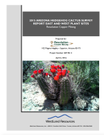
2015 Arizona Hedgehog Cactus Survey Report East and West Plant Sites | WestLand Resources Inc. 2015a. 2015 Arizona Hedgehog Cactus Survey Report East and West Plant Sites. Resolution Copper Mining. Download PDF |
| Ecological Overview Apache Leap South End Parcels Pinal County, Arizona | WestLand Resources Inc. 2015b in prep. Ecological Overview Apache Leap South End Parcels Pinal County, Arizona. In preparation for Resolution Copper Mining. |
|
|
Ecological Overview: San Pedro River Parcel, Pinal County, Arizona | WestLand Resources. 2003. Ecological Overview: San Pedro River Parcel, Pinal County, Arizona. Job No. 807.03 SP 340. Prepared for Resolution Copper. Tucson, Arizona: WestLand Resources Inc. September 10. Download PDF |
|
Ecological Overview: Appleton Ranch Parcel, Santa Cruz County, Arizona | WestLand Resources. 2004b. Ecological Overview: Appleton Ranch Parcel, Santa Cruz County, Arizona. Job No. 807.06 RR 300. Prepared for Resolution Copper. Tucson, Arizona: WestLand Resources Inc. May 26. Download PDF |
|
Ecological Overview: JX Ranch Parcel, Gila County, Arizona | WestLand Resources. 2004c. Ecological Overview: JX Ranch Parcel, Gila County, Arizona. Job No. 807.06 JX 300. Prepared for Resolution Copper. Tucson, Arizona: WestLand Resources Inc. March 31. Download PDF |
|
Ecological Overview: LX Bar Ranch Parcel, Yavapai County Arizona | Westland Resources. 2004d. Ecological Overview: LX Bar Ranch Parcel, Yavapai County Arizona. Job No. 807.06 TC 300. Prepared for Resolution Copper. Tucson, Arizona: WestLand Resources Inc. March 3. Download PDF |
|
Phase I Site Assessment Non-Federal Parcel - Dripping Springs | WestLand Resources. 2015a. Phase I Environmental Site Assessment: Non-Federal Parcel - Dripping Springs, Gila County, Arizona. Project No. 807.98. Prepared for Resolution Copper. Tucson, Arizona: WestLand Resources Inc. June 24. Download PDF |
|
Phase I Environmental Site Assessment Apache Leap South End | WestLand Resources. 2015b. Phase I Environmental Site Assessment: Non-Federal Parcel, Apache Leap South End, Gila County, Arizona. Project No. 807.98. Prepared for Resolution Copper. Tucson, Arizona: WestLand Resources Inc. August 13. Download PDF |
|
Ecological Overview: Dripping Springs Parcel, Gila and Pinal Counties, Arizona | WestLand Resources. 2016a. Ecological Overview, Dripping Springs Parcel, Gila and Pinal Counties, Arizona: Resolution Copper. Project Number: 807.98 13 06. Prepared for Resolution Copper. Tucson, Arizona: WestLand Resources Inc. December. Download PDF |

|
Ecological Overview East Clear Creek Parcel | WestLand Resources. 2017b. Ecological Overview, East Clear Creek Parcel, Coconino County, Arizona: Resolution Copper. Project Number: 807.98 13 06. Prepared for Resolution Copper. Tucson, Arizona: WestLand Resources Inc. January 24. Download PDF |
|
Avian Surveys Conducted by Audubon Arizona IBA Program at 7B Ranch, Lower San Pedro River, Mammoth, Arizona, 2006-2010 | Wilbor, S. 2010. Avian surveys conducted by Audubon Arizona IBA Program at 7B Ranch, Lower San Pedro River, Mammoth, Arizona, 2006-2010. Tucson Audubon Society. Download PDF |
|
An Archaeological Survey of the Lakeside Land Exchange, Superior Parcel, Superior Arizona, Globe Range District, Tonto National Forest | Wood, J. Scott. 1976. An Archaeological Survey of the Lakeside Land Exchange, Superior Parcel, Superior Arizona, Globe Range District, Tonto National Forest. Cultural Resources Inventory Report 76-09, Tonto National Forest. October 1976. Download PDF |
|
Settlement and Reoccupation along Queen Creek, Central Arizona: An Archaeological Survey of the Superior Proposed Based for Exchange (South Half), Globe Ranger District, Tonto National Forest | Wood, J. Scott. 1979. Settlement and Reoccupation along Queen Creek, Central Arizona: An Archaeological Survey of the Superior Proposed Based for Exchange (South Half), Globe Ranger District, Tonto National Forest. Cultural Resources Report No. 29. USDA Forest Service Southwestern Region, Albuquerque, New Mexico. Download PDF |
|
Perry Mesa, a Visitor's Guide | Wood, J. Scott. 1999. Perry Mesa, a Visitor's Guide. Tonto National Forest. 1999. Download PDF |

