Documents Cited - Land Exchange

|
Web Soil Survey | Soil Survey Staff. 2015. Natural Resources Conservation Service, United States Department of Agriculture. Web Soil Survey. Online data retrieved at Web Soil Survey. Accessed March 11, 2015. Download PDF |

|
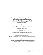
Geologic Map of the Picketpost Mountain and the Southern Part of the Iron Mountain 7 112' Quadrangles | Spencer, J.E., and S.M. Richard. 1995. Geologic Map of the Picketpost Mountain and the Southern Part of the Iron Mountain 7 1/2' Quadrangles, Pinal County, Arizona. Open-File Report 95-15. Tucson: Arizona Geological Survey. September. Download PDF |

|
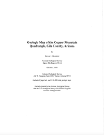
Geologic Map of the Copper Mountain Quadrangle, Gila County, Arizona | Stotnicki, Stephen J. 1999. Geologic Map of the Copper Mountain Quadrangle, Gila County, Arizona, Open-File Report 99-24. Arizona Geological Society. October 1999. Download PDF |

