Documents Cited - General Plan of Operations
|
Appendix I: Calculating California Seismicity Rates | Felzer, K.R., 2008, Calculating California seismicity rates, Appendix I in the Uniform California Earthquake Rupture Forecast, version 2: U.S. Geological Survey Open-File Report 2007- 1437I. Download PDF |
|
Geology of the Florence Junction and Southern Portion of the Weavers Needle 7.5' Quadrangles, Pinal County, Arizona | Ferguson, C.A. and Skotnicki, S.J., 1995, Geology of the Florence Junction and southern portion of the Weavers Needle 7.5' Quadrangles, Pinal County, Arizona: Arizona Geological Survey Open-File Report 95-10, includes 1:24,000 scale geologic map, cross-sections, 27 p. Download PDF |
|
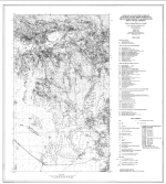
Geologic Map of the Florence Junction and Southern Portion of the Weavers Needle 7.5' Quadrangles, Pinal County, Arizona | Ferguson, C.A., and S.J. Skotnicki. 1996. Geologic Map of the Florence Junction and Southern Portion of the Weavers Needle 7.5' Quadrangles, Pinal County, Arizona. Tucson: Arizona Geological Survey. Download PDF |
|
Drainage Design Manual for Maricopa County; Hydrology | Flood Control District of Maricopa County (FCD). 2011. Drainage Design Manual for Maricopa County; Hydrology. February 2011. Download PDF |
|
Mapping Seismic Hazard in the Central and Eastern United States | Frankel, A., 1995, Mapping seismic hazard in the central and eastern United States: Seismological Research Letters, v. 66, p. 8-21. Download PDF |

