Breadcrumb

  1. Home
  2. Documents

Documents

This report summarizes meteorological measurements collected at the Resolution Copper Mine monitoring system. The purpose of the monitoring program is to provide the measurements necessary to establish existing meteorological conditions at the proposed site of the Resolution Mine in support of a future air quality permit application.

In February 2010, Montgomery published a report entitled "Interim Results of Groundwater Monitoring, Upper Queen Creek and Devils Canyon Watersheds" (M&A 2010) which reported all hydrochemical and isotopic data available through the second quarter of 2009. The current report presents hydrochemical and isotopic data collected since M&A 2010 was published.

This report compares the floodplain and wetlands inventories for five offered lands ("Non-Federal Parcels") to the "Federal Parcel". The Non-Federal Parcels are: JX Ranch, Appleton Ranch, LX Bar Ranch, 6L Ranch, 7B Ranch. The Federal Parcel is also known as the Resolution Parcel, and will be so referenced in this report.

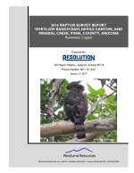
Bird surveys in the Resolution Study Area to establish baseline information about bird species in the area. The goals of this report are to summarize avian surveys and assemble a list of avian species in the Study Area.

Reptile and amphibian survey was conducted on the approximately 1,224-hectare Federal Parcel.

This draft technical memorandum has been prepared to summarize results of drilling, construction, and development of groundwater production well RESPW-01. The well was installed to intersect mine workings on the 4400 Mine Level adjacent to Shaft No. 8 of the Magma Mine in order to dewater that level and overlying levels.

The purpose of this traffic study is to evaluate the current and future transportation system at the proposed Resolution Copper Mine expansion without and with the project. Traffic operations were analyzed at existing, key intersections located near the proposed mining operations and facilities during construction and final operations.

This report summarizes the meteorological, upper-air (SoDAR), nitrogen dioxide (NO2), sulfur dioxide (SO2), ozone (O3), and particulate matter (PM) data collected at the Resolution Copper Project near Superior, Arizona, for the fourth quarter, October 1 through December 31, 2016.

Surveys were conducted for special-status plant species associated with water features that occur in the vicinity of the Study Area.

This report summarizes meteorological measurements collected at the Resolution Copper Mine monitoring system.  The purpose of the monitoring program is to provide the measurements necessary to establish existing meteorological conditions at the proposed site of the Resolution Mine in support of a future air quality permit application for the facility.