Proposal to list the monarch butterfly (Danaus plexippus), the iconic orange and black butterfly, as a threatened species and designate critical habitat under the Endangered Species Act of 1973, as amended (Act).
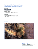
Assessment of the impacts of the Telegraph Fire on Arizona hedgehog cactus (AHC; Echinocereus triglochidiatus var. arizonicus) located east of the town of Superior in Pinal County, Arizona.
Materials that meet the criteria of Freedom of Information Act exemptions are not posted on this website. Culturally sensitive materials not posted here fall under this criteria.
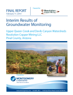
Groundwater monitoring in the upper Queen Creek and Devils Canyon watersheds was initiated by RCM in early 2004. The current RCM groundwater monitoring program includes 19 wells, boreholes or shafts. Based on results of hydrogeological characterization studies conducted to date, three principal aquifers have been identified. The purpose of the groundwater monitoring program is to provide hydrologic data for continued development and refinement of the conceptual hydrogeologic model for the ALT aquifer and adjacent aquifers in the study area that might be impacted by block-c
This report summarizes the meteorological, nitrogen dioxide (NO2), sulfur dioxide (SO2), ozone (O3), and particulate matter (PM) data collected at the Resolution Copper Project near Superior, Arizona for the first quarter, January 1-March 31, 2013.
An investigation of hydrogeologic conditions for the Superior Basin has been completed by Montgomery. The chief objective of the survey was to evaluate the cause of recent water level declines reported for some wells located within and adjacent to the Queen Creek corridor through the Superior Basin, as well as observed declines in discharge from Whitlow Ranch Dam.
Three motion-sensitive cameras besides springs within a study area along Devils Canyon. Cameras captured numerous identifiable images of animals representing both mammals and bird species.
The purposes of this BE are: 1) to describe the physical and biological features of the Analysis Area, 2) to describe and map the plant communities, and 3) to identify the potential for special status species to occur within the Analysis Area.