Breadcrumb

  1. Home
  2. Documents

Documents

The Assured and Adequate Water Supply Rules require applicants to submit hydrologic information to support certain aspects of their applications.

COVER ONLY

Materials that meet the criteria of Freedom of Information Act exemptions are not posted on this website. Culturally sensitive materials not posted here fall under this criteria.

An energy system powered by clean energy technologies differs profoundly from one fuelled by traditional hydrocarbon resources. Building solar photovoltaic (PV) plants, wind farms and electric vehicles (EVs) generally requires more minerals than their fossil fuel- based counterparts. A typical electric car requires six times the mineral inputs of a conventional car, and an onshore wind plant requires nine times more mineral resources than a gas-fired power plant.

Bureau of Land Management's (BLM) review included several comments on the Tailings Storage Facility (TSF) design related to stormwater management. This letter provides clarifications and information on the TSF stormwater management design to address the BLM comments.

We, the U.S. Fish and Wildlife Service (Service), designate critical habitat for the northern Mexican gartersnake (Thamnophis eques megalops) under the Endangered Species Act of 1973 (Act), as amended.

This inventory is an update of soil and range information and maps of the National Audubon Society Appleton-Whittell Research Ranch that is within the Soil Survey of Santa Cruz and Parts of Cochise and Pima Counties, Arizona.

This report summarizes the meteorological, nitrogen dioxide (NO2), sulfur dioxide (SO2), ozone (O3), and particulate matter (PM) data collected at the Resolution Copper Project near Superior, Arizona for the fourth quarter, October 1-December 31, 2012.

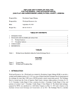
Wetland and floodplain analysis of a 2,422-acre area of federal land being proposed for exchange for more than 5,000 acres of RCM privately owned conservation parcels.

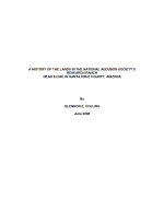
The Research Ranch, near Elgin in Santa Cruz County, Arizona, is administered by the National Audubon Society. It consists of about 8000 acres of federal and private lands that are managed for ecosystem research projects by the National Audubon Society, which has cooperative agreements with the federal land management agencies. This summary of the early history of land settlement of the Research Ranch area and some of the subsequent land transactions is taken primarily from information in the land records of the BLM and ASLD.