Breadcrumb

  1. Home
  2. Documents

Documents

There are about a dozen major hydrogeochemical processes that can account for the chemical composition of most natural waters. One of these is the oxidation of pyrite, a process at least as important a source of sulfate in natural waters as seawater and sea spray, gypsum dissolution, and atmospheric emissions. The natural process of pyrite oxidation is fundamental to the super-gene alteration of ore deposits, the formation of acid-sulfate soils, and the development of acidity and metal mobilization in natural waters.

The commonly used Uniform Hazard Spectrum (UHS) is shown here to be an unsuitable target for this purpose, as it conservatively implies that large-amplitude spectral values will occur at all periods within a single ground motion. An alternative, termed a Conditional Mean Spectrum (CMS), is presented here.

Exposures we have excavated across the San Andreas fault contradict the hypothesis that part of the fault in the Carrizo Plain is unusually strong and experiences relatively infrequent rupture. The exposures record evidence of at least seven surface-rupturing earthquakes which have been approximately dated by accelerated mass spectrometry radiocarbon analysis of detrital charcoal and buried in situ plants.

The Rio Grande rift has a relatively short and unimpressive record of historical seismicity. However there is abundance evidence of prehistoric (Quaternary) surface faulting associated with large (M>6) earthquakes. This paradox between historical and prehistoric seismicity (paleoseismicity) has important implications for seismic-hazards analyses based primarily on modern seismicity.

The 2008 U.S. Geological Survey (USGS) National Seismic Hazard Maps display earthquake ground motions for various probability levels across the United States and are applied in seismic provisions of building codes, insurance rate structures, risk assessments, and other public policy.

In this paper the 100-year sample of earthquakes known to have occurred in the Puget Sound area between 1870 and 1969 ls evaluated for completeness and the question of fitting the frequency formula log N = a + bl0 to biased samples that are short with respect to the recurrence Interval of the largest earthquakes contained 111 them ts studied.

This Ecological Overview was prepared for approximately 160 acres (65 hectares) in Gila and Pinal counties, Arizona. The Dripping Springs parcel is a private inholding within the Bureau of Land Management (BLM) lands (and adjacent to Arizona State Trust Lands), located along the Dripping Spring Mountains about 8 miles (13 kilometers [km]) north of the town of Hayden.

This report summarizes the meteorological, upper-air (SoDAR1), nitrogen dioxide (NO2), sulfur dioxide (SO2), ozone (O3), and particulate matter (PM) data collected at the Resolution Copper Project near Superior, Arizona, for the third quarter, July 1 through September 30, 2017.

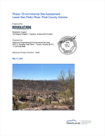
COVER ONLY

This material is protected under copyright law and will not be posted to this website.