This report summarizes the meteorological, nitrogen dioxide (NO2), sulfur dioxide (SO2), ozone (O3), and particulate matter (PM) data collected at the Resolution Copper Project near Superior, Arizona for the second quarter, April 1-June 30, 2014.
Baseline Biology and Land Use Report describing a parcel of federal land in the Tonto National Forest. Resolution intends to obtain the Parcel by way of a land exchange with the U.S. Forest Service and to conduct studies to determine the feasibility of establishing an underground copper mine at the site.
Biological baseline studies were conducted related to a proposed tailings alternative within the Tonto National Forest as outlined in a GPO, and related to proposed baseline activities in support of mining exploration activities in the same general area as described in a Plan of Operations.
Resolution Copper Mining LLC (RCML) intends to implement a meteorological and air quality monitoring program to support several efforts during the pre-feasibility and other mine development phases.
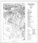
The study area is situated along the southern edge of the Superstition Mountains approximately 40 miles east of the greater Phoenix metropolitan area (Figure 1). Geology is dominated by mid-Tertiary volcanic rocks of the Superior volcanic field (Ransome, 1903), and these rocks depostionally overlie a crystalline basement of early Proterozoic Pinal Schist intruded by middle Proterozoic granitoids. In some areas a relatively thin sequence of the Middle Proterozoic Apache Group occurs along the contact between these two rock types.
This Environmental Impact Statement (EIS) describes a Proposed Action (Preferred Alternative) and alternatives to the Proposed Action for the future management of the land and resources of the Tonto National Forest.
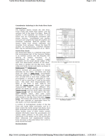
The Verde River Basin is a relatively large basin that encompasses part of the Coconino Plateau in its northern portion with the Mogollon Rim defining its eastern boundary. It is characterized by steep canyons, rugged mountains and by broad alluvial valleys in the north and west-central portions of the basin.