Breadcrumb

  1. Home
  2. Documents
  3. Baseline Reports

Baseline Reports

The documents listed below represent baseline information collected by Resolution Copper and provided to the Tonto National Forest to be used as a partial basis for the analysis in the EIS. The Tonto National Forest will independently evaluate any data provided by Resolution Copper that is used in the EIS to ensure that it is valid, adequate to support the analysis, and represents the best available science.

This report summarizes the meteorological, upper air, nitrogen dioxide (NO2), sulfur dioxide (SO2), ozone (O3), and particulate matter (PM) data collected at the Resolution Copper Project near Superior, Arizona for the fourth quarter, October 1 – December 31, 2015.

This report summarizes the meteorological, upper air, nitrogen dioxide (NO2), sulfur dioxide (SO2), ozone (O3), and particulate matter (PM) data collected at the Resolution Copper Project near Superior, Arizona for the third quarter, July 1 – September 30, 2015.

Yellow-billed cuckoo surveys at four sites in the vicinity of the Resolution Copper Project conducted in 2015. Surveys were conducted at the Whitlow Ranch Dam, two portions of Devils Canyon, and one segment of Mineral Creek, all in Pinal County, Arizona.

Earth Systems was engaged to conduct kinetic geochemical testwork on tailings samples generated from pilot scale metallurgical testwork for the Resolution Copper Mine.

This report summarizes the meteorological, nitrogen dioxide (NO2), sulfur dioxide (SO2), ozone (O3), and particulate matter (PM) data collected at the Resolution Copper Project near Superior, Arizona for the second quarter, April 1-June 30, 2015.

Wetland and floodplain analysis of a 2,422-acre area of federal land being proposed for exchange for more than 5,000 acres of RCM privately owned conservation parcels.

This report summarizes the meteorological, nitrogen dioxide (NO2), sulfur dioxide (SO2), ozone (O3), and particulate matter (PM) data collected at the Resolution Copper Project near Superior, Arizona for the first quarter, January 1-March 31, 2015.

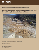
This report presents a flood-duration flow frequency analysis for selected durations (1 day, 3 day, 7 day, 15 day, and 30 day) at 173 streamgaging stations throughout Arizona and in western New Mexico.

This report summarizes the meteorological, nitrogen dioxide (NO2), sulfur dioxide (SO2), ozone (O3), and particulate matter (PM) data collected at the Resolution Copper Project near Superior, Arizona for the fourth quarter, October 1-December 31, 2014.