Breadcrumb

  1. Home
  2. Documents

Documents

This report summarizes the meteorological, nitrogen dioxide (NO2), sulfur dioxide (SO2), ozone (O3), and particulate matter (PM) data collected at the Resolution Copper Project near Superior, Arizona for the second quarter, April 1-June 30, 2013.

In 1995, the Magma Copper Company discovered a porphyry copper deposit beneath thick postmineral cover 2 km south of the historic Magma mine in Superior, Arizona. Since that time drilling has delineated a large, high-grade, hypogene copper-molybdenum deposit, now named the Resolution deposit, with an inferred resource of 1,624 million metric tons (Mt) at 1.47% Cu and 0.037% Mo.

Fish surveys were conducted in order to determine the presence of absence of the Gila chub, as well as other native fishes within portions of Devils Canyon and upper Mineral Creek, and within two stock tanks in the vicinity of the Project. The Gila chub is listed by USFWS as endangered with critical habitat under the ESA.

Surveys reported here focus specifically on potential habitat for amphibians: the lentic habitats (ponds and stock tanks) and lotic habitats (ephemeral drainages and creeks) in the Oak Flat/East Plant Area, including portions of Devils Canyon south of U.S. Route 60.

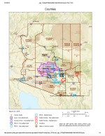
Website with ADEQ's eMaps of nonattainment, attainment, and maintenance areas.

Community profile information about San Carlos, Arizona.

The Picketpost Mountain and Iron Mountain 7.5' quadrangles are located east of the Phoenix metropolitan area and are within the Basin and Range physiographic and tectonic province of southwestern North America.

This experience demonstrated that reclamation requirements and bonds for mining operations on federal lands in the Western United States were inadequate in some cases.