Breadcrumb

  1. Home
  2. Documents
  3. Baseline Reports

Baseline Reports

The documents listed below represent baseline information collected by Resolution Copper and provided to the Tonto National Forest to be used as a partial basis for the analysis in the EIS. The Tonto National Forest will independently evaluate any data provided by Resolution Copper that is used in the EIS to ensure that it is valid, adequate to support the analysis, and represents the best available science.

This assessment provides background information on concepts related to environmental sound.

This report summarizes the meteorological, upper-air (SoDAR), nitrogen dioxide (NO2), sulfur dioxide (SO2), ozone (O3), and particulate matter (PM) data collected at the Resolution Copper Project near Superior, Arizona, for the fourth quarter, October 1 through December 31, 2016.

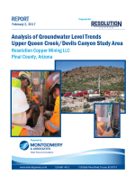
The principal objective of this report is to present and review groundwater level and hydraulic head data for the RC hydrologic monitoring network.

A series of stream gauges is located within the upper Queen Creek, Devil’s Canyon, and Mineral Creek watersheds, located near Superior, AZ. These gauges are owned and maintained by Resolution Copper Mining (RCM). The historical stream gauge records were analyzed by JE Fuller Hydrology & Geomorphology, Inc in order provide an assessment of the quantity and quality of the surface water data. These data were also used to characterize and quantify volumetric surface water discharge characteristics in the three watersheds.

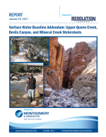
This report is an addendum to the Surface Water Baseline Report prepared by M&A (2013) that includes detailed analysis and discussion of surface water monitoring results in the Resolution Project study area; Devils Canyon, Queen Creek, and Mineral Creek.

Passive survey for raptors in 2016 were conducted at four sites in the vicinity of the Resolution Copper Project. Survey was conducted at the Whitlow Ranch Dam, two portions of Devils Canyon, and one segment of Mineral Creek, all in Pinal County, Arizona.

The Apache Leap South End parcels are three non-contiguous private inholdings within the Tonto National Forest. The Property is situated along the southern end of the Apache Leap, a prominent geologic feature that visually dominates the skyline east of the town of Superior, Arizona.

The East Clear Creek parcel is a private inholding within the Coconino National Forest, located along East Clear Creek about 38 miles (61 kilometers [km]) southwest of the town of Winslow. The Property encompasses uplands of the Colorado Plateau as well as an approximately 2.3-mile (3.7-km) reach of East Clear Creek in a narrow canyon.

This Ecological Overview was prepared for approximately 160 acres (65 hectares) in Gila and Pinal counties, Arizona. The Dripping Springs parcel is a private inholding within the Bureau of Land Management (BLM) lands (and adjacent to Arizona State Trust Lands), located along the Dripping Spring Mountains about 8 miles (13 kilometers [km]) north of the town of Hayden.

Phase I Environmental Site Assessment (ESA) for approximately 148 acres referred to as the Tangle Creek parcel.