Documents Cited - Final EIS
|
Invasive Species Compendium | CABI. 2018. Invasive Species Compendium. Wallingford, UK: CAB International. Available at: Invasive Species Compendium. Accessed April 12, 2018. Download PDF |

|
Carrichtera annua | California Invasive Plant Council. 2025. Carrichtera annua. Available at: Carrichtera annua page on CAL-IPC website. Accessed March 18, 2025. Download PDF |
|
Apache Leap Special Management Area: Biological Evaluation | Campbell, S., and M. Dugan. 2017. Apache Leap Special Management Area: Biological Evaluation. Phoenix, Arizona: SWCA Environmental Consultants Inc. September. Download PDF |
|
Technical Bulletin: Application of Dam Safety Guidelines to Mining Dams | Canadian Dam Association. 2014. Technical Bulletin: Application of Dam Safety Guidelines to Mining Dams. Toronto, Canada. Download PDF |
|
Railway Noise Measurement and Reporting Methodology | Canadian Transportation Agency. 2011. Railway Noise Measurement and Reporting Methodology. Ottowa, Canada: Canadian Transportation Agency. August. Download PDF |

|
Assessment of Potential for Caving-Induced Fault Slip Seismicity at Resolution Copper Mine | Cancino, C., T. Garza-Cruz, and M. Pierce. 2019a. Assessment of Potential for Caving-Induced Fault Slip Seismicity at Resolution Copper Mine. 2-4208-06:19R47. Minneapolis, Minnesota: Itasca Consulting Group, Inc. and Pierce Engineering. October 1. Download PDF |
|
Empirical Analysis of Surface Subsidence Associated with Caving, Resolution Copper Mine Plan of Operations | Cancino, C., T. Garza-Cruz, and M. Pierce. 2019b. Empirical Analysis of Surface Subsidence Associated with Caving, Resolution Copper Mine Plan of Operations. Minneapolis, Minnesota: Itasca Consulting Group, Inc. and Pierce Engineering. May 16. Download PDF |
|
A Historic Building Inventory of Superior, Top-of-the-World, Miami, and Globe, Pinal and Gila Counties, Arizona | Caroli, B. 2021. A Historic Building Inventory of Superior, Top-of-the-World, Miami, and Globe, Pinal and Gila Counties, Arizona. Project/Report Nos.: 807.215/2021-14. Tucson, Arizona: WestLand Resources, Inc. June 8. Download PDF |
|
Rainwater as a Chemical Agent of Geologic Processes - A Review | Carroll, D. 1962. Rainwater as a Chemical Agent of Geologic Processes - A Review. Geological Survey Water-Supply Paper 1535-G. Washington D.C.: U.S. Geological Survey. Download PDF |
|
Invasive Plants of the Sonoran Desert: A Field Guide | Chambers, N., and T.O. Hawkins. 2002. Invasive Plants of the Sonoran Desert: A Field Guide. Tucson, Arizona: Sonoran Institute. Download PDF |
|
A Cultural Resources Inventory in Support of a Plan of Operation For Monitor Well Sites G and R and Associated Access Roads Located Within Section 5, Township 2 South, Range 13 East, Pinal County, Arizona | Chamorro, S. 2014a. A Cultural Resources Inventory in Support of a Plan of Operation For Monitor Well Sites G and R and Associated Access Roads Located Within Section 5, Township 2 South, Range 13 East, Pinal County, Arizona. Arizona State Land Department Exploration Permit Number 08-115472. Accession Number 2013-557. Cultural Resources Report 2013-80. Project No. 0807.94 A 01-520. Tucson, Arizona: WestLand Resources, Inc. January 9. Download PDF |
|
A Cultural Resources Inventory of 12.92 Acres An Addendum to the Resolution Project: A Cultural Resources Inventory of Baseline Hydrologic and Geotechnical Data-Gathering Sites and Access Roads in the Foothills of the Superstition Mountains | Chamorro, S. 2014b. A Cultural Resources Inventory of 12.92 Acres An Addendum to the Resolution Project: A Cultural Resources Inventory of Baseline Hydrologic and Geotechnical Data-Gathering Sites and Access Roads in the Foothills of the Superstition Mountains, Northwest of Superior, Arizona. Cultural Resources Report 2014-58. Project No. 807.94 06 05-110. Tucson, Arizona: WestLand Resources, Inc. November 13. Download PDF |
|
A Cultural Resources Inventory of 1,153 Acres Within the East and West Plan Sites for the Resolution Copper Project, in and Near Superior, Pinal County, Arizona | Chamorro, S. 2015. A Cultural Resources Inventory of 1,153 Acres Within the East and West Plan Sites for the Resolution Copper Project, in and Near Superior, Pinal County, Arizona. Cultural Resources Report 2015-24. ASM Accession No. 2015-0061. Tonto National Forest Permit No. TON 883. Project No. 807.101. Tucson, Arizona: WestLand Resources, Inc. October 12. Download PDF |
|
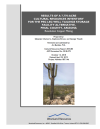
Results of a 7,770-Acre Cultural Resources Inventory for the Peg Leg Well Tailings Storage Facility Alternative, Pinal County, Arizona, Resolution Copper Mining | Chamorro, S., S. Brown, and G. Tinseth. 2019. Results of a 7,770-Acre Cultural Resources Inventory for the Peg Leg Well Tailings Storage Facility Alternative, Pinal County, Arizona, Resolution Copper Mining. Cultural Resources Report 2018-85. Project Number: 807.146. Tucson, Arizona: WestLand Resources Inc. April 22. Download PDF |
|
A Cultural Resources Inventory of 84.2 Acres of Tonto National Forest and Private Land in Support of the Resolution Copper Project General Plan of Operations Near Superior, Pinal County, Arizona | Chamorro, S., B. Stone, and C. Daughtrey. 2016. A Cultural Resources Inventory of 84.2 Acres of Tonto National Forest and Private Land in Support of the Resolution Copper Project General Plan of Operations Near Superior, Pinal County, Arizona, Resolution Copper. Cultural Resources Report 2016-53. Project Number: 807.125. Tucson, Arizona: WestLand Resources, Inc. November 29. Download PDF |
|
Results of a 2,885-Acre Cultural Resources Inventory for the Silver King Filtered Tailings Storage Alternative Near Superior, Pinal County, Arizona, Resolution Copper | Chamorro, S., G. Tinseth, S. Brown, and J. Bernatchez. 2019. Results of a 2,885-Acre Cultural Resources Inventory for the Silver King Filtered Tailings Storage Alternative Near Superior, Pinal County, Arizona, Resolution Copper. Cultural Resources Report 2018-94. Project Number: 807.148. Tucson, Arizona: WestLand Resources Inc. March 26. Download PDF |
|
A Cultural Resources Inventory of 159.64 Acres for the Dripping Spring Land Exchange, Gila and Pinal Counties, Arizona | Charest, J.P. 2016a. A Cultural Resources Inventory of 159.64 Acres for the Dripping Spring Land Exchange, Gila and Pinal Counties, Arizona. Cultural Resources Report 2015-36. Project No. 807.102 0520 03-0555. Tucson, Arizona: WestLand Resources Inc. July 5. Download PDF |
|
A Cultural Resources Inventory of the 146.78-Acre Turkey Creek Parcel, Gila County, Arizona | Charest, J.P. 2016b. A Cultural Resources Inventory of the 146.78-Acre Turkey Creek Parcel, Gila County, Arizona: Resolution Copper. Cultural Resources Report 2016-45. Project Number: 807.112 0520 03-0555. Tucson, Arizona: WestLand Resources Inc. September 28. Download PDF |
|
A Cultural Resources Inventory of the 148-Acre Tangle Creek Parcel, Yavapai County, Arizona: Resolution Copper | Charest, J.P. 2016c. A Cultural Resources Inventory of the 148-Acre Tangle Creek Parcel, Yavapai County, Arizona: Resolution Copper. Cultural Resources Report 2016-40. Project Number: 807.111 02 02-0520. Tucson, Arizona: WestLand Resources, Inc. September 28. Download PDF |
|
A Cultural Resources Inventory of the 633.88-Acre East Clear Creek Parcel, Coconino County, Arizona | Charest, J.P. 2016d. A Cultural Resources Inventory of the 633.88-Acre East Clear Creek Parcel, Coconino County, Arizona. Cultural Resources Report 2015-60. Project No. 807.113 520 03-0555. Tucson, Arizona: WestLand Resources Inc. September 28. Download PDF |
|
A Cultural Resources Inventory in Support of the Resolution Copper General Plan of Operations 230-KV and 115-KV Transmission Lines, Gila and Pinal Counties, Arizona | Charest, J.P. 2020. A Cultural Resources Inventory in Support of the Resolution Copper General Plan of Operations 230-KV and 115-KV Transmission Lines, Gila and Pinal Counties, Arizona. Cultural Resources Report 2020-9. ASM Accession No. 2019-0247. Project Number: 807.169. Tucson, Arizona: WestLand Resources, Inc. September 1. Download PDF |
|
A Cultural Resources Inventory of the 149.18-Acre Cave Creek Parcel, Maricopa County, Arizona | Charest, J.P., and C.M. Francis. 2016. A Cultural Resources Inventory of the 149.18-Acre Cave Creek Parcel, Maricopa County, Arizona: Resolution Copper. Cultural Resources Report 2016-44. Project Number: 807.107 0520 03-0555. Tucson, Arizona: WestLand Resources Inc. September 28. Download PDF |
|
Herpetofauna of the Appleton-Whittell Research Ranch | Cogan, R.C. 2012. Herpetofauna of the Appleton-Whittell Research Ranch. Elgin, Arizona: National Audubon Society. November. Download PDF |
|
Traditional Cultural Properties and the Hopi Model of Cultural Preservation | Colwell, C., and S.B. Koyiyumptewa. 2018. Traditional Cultural Properties and the Hopi Model of Cultural Preservation. In Footprints of Hopi History: Hopihiniwtiput Kukveni'at, edited by L.J. Kuwanwisiwma, T.J. Ferguson, and C. Colwell. Tucson, Arizona: University of Arizona Press. Download PDF |
|
Resolution Class III Cultural Resources Survey Along 2.5 Miles of Magma Arizona Railroad on State Trust Land Pinal County, Arizona | Cook, M.D. 2007a. Resolution Class III Cultural Resources Survey Along 2.5 Miles of Magma Arizona Railroad on State Trust Land Pinal County, Arizona. Cultural Resources Report 2007-15. Project No. 807.12. Tucson, Arizona: WestLand Resources, Inc. April 11. Download PDF |
|
Resolution Class III Cultural Resources Survey Along Magma Arizona Railroad on State Trust Land Pinal County, Arizona | Cook, M.D. 2007b. Resolution Class III Cultural Resources Survey Along Magma Arizona Railroad on State Trust Land Pinal County, Arizona. ASM Accession No. 2007-0213. Cultural Resources Report 2007-12. Project No. 807.12. Tucson, Arizona: WestLand Resources, Inc. April 2. Download PDF |
|
Appropriate Use of Mitigation and Monitoring and Clarifying the Appropriate Use of Mitigated Findings of No Significant Impact | Council on Environmental Quality. 2011. Appropriate Use of Mitigation and Monitoring and Clarifying the Appropriate Use of Mitigated Findings of No Significant Impact. Prepared by N.H. Sutley. Memorandum. Washington, D.C.: Executive Office of the President, Council on Environmental Quality. January 14. Download PDF |
|
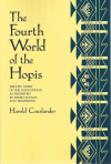
The Fourth World of the Hopis: The Epic Story of the Hopi Indians as Preserved in Their Legends and Traditions | Courlander, H. 1971. The Fourth World of the Hopis: The epic story of the Hopi Indians as preserved in their legends and traditions. Albuquerque, New Mexico: University of New Mexico. Download PDF |
|
Hydrogeologic Data Submittal, Tailings Prefeasibility Study, Whitford, Silver King, and Happy Camp Sites | Cross, M., and J. Blainer-Fleming. 2012. Hydrogeologic Data Submittal, Tailings Prefeasibility Study, Whitford, Silver King, and Happy Camp Sites. Project: 605.741. Draft technical memorandum. Tucson, Arizona: Montgomery and Associates Inc. October 23. Download PDF |
|
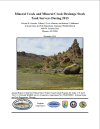
Mineral Creek and Mineral Creek Drainage Stock Tank Surveys During 2013 | Crowder, C.D., T.S. Love-Chezem, and A.S. Makinster. 2014. Mineral Creek and Mineral Creek Drainage Stock Tank Surveys During 2013. Phoenix, Arizona: Nongame Wildlife Branch, Arizona Game and Fish Department. December. Download PDF |

