Breadcrumb

  1. Home
  2. Documents
  3. Baseline Reports

Baseline Reports

The documents listed below represent baseline information collected by Resolution Copper and provided to the Tonto National Forest to be used as a partial basis for the analysis in the EIS. The Tonto National Forest will independently evaluate any data provided by Resolution Copper that is used in the EIS to ensure that it is valid, adequate to support the analysis, and represents the best available science.

An investigation of hydrogeologic conditions for the Superior Basin has been completed by Montgomery. The chief objective of the survey was to evaluate the cause of recent water level declines reported for some wells located within and adjacent to the Queen Creek corridor through the Superior Basin, as well as observed declines in discharge from Whitlow Ranch Dam.

Arizona hedgehog cactus surveys conducted in the vicinity of East Plant, along portions of the existing Magma Mine Road, and along the proposed re-alignment of Magma Mine Road.

Surveys were conducted for Morafka's desert tortoise (Gopherus morafkai, formerly G. agassizii, Sonoran population) within the Far West property located near Florence Junction, Arizona.

An evaluation of an approximately 560-acre private parcel for the presence of potential waters of the U.S.

This report summarizes the meteorological, nitrogen dioxide (NO2), sulfur dioxide (SO2), ozone (O3), and particulate matter (PM) data collected at the Resolution Copper Project near Superior, Arizona for the third quarter, July 1-September 30, 2012.

Surveys reported here focus specifically on potential habitat for amphibians: the lentic habitats (ponds and stock tanks) and lotic habitats (ephemeral drainages and creeks) in the Oak Flat/East Plant Area, including portions of Devils Canyon south of U.S. Route 60.

Reptile community surveys at the Far West parcel and along portions of State Route 79 and US 60 located near Florence Junction.

At HRES-19 and HRES-20, the primary target drilling depth was the contact between the Tertiary Apache Leap Tuff and the underlying White Tail Conglomerate. During drilling operations, data was collected to better characterize the hydrogeologic conditions within the Apache Leap Tuff. The target depth was reached at HRES-19, although the depth to the White Tail Conglomerate was shallower than expected. The White Tail Conglomerate was not reached at HRES-20 due to technical issues encountered while drilling.

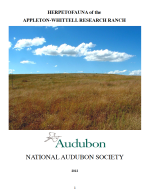
This is a summary of personal observations and impressions of the continued presence or absence of the herpetofauna which have been previously reported at the Appleton-Whittell Research Ranch. A total of fifty-two amphibian and reptile species have been reported within the Research Ranch boundaries. The continued existence of several species may be in doubt.

This report summarizes the meteorological, nitrogen dioxide (NO2), sulfur dioxide (SO2), ozone (O3), and particulate matter (PM) data collected at the Resolution Copper Project near Superior, Arizona for the second quarter, April 1-June 30, 2012.