Documents Cited - Draft EIS
|
Tailings Dam Failures: Updated Statistical Model for Discharge Volume and Runout | Larrauri, P.C., and U. Lall. 2018. Tailings dam failures: Updated statistical model for discharge volume and runout. Environments 5(28). Download PDF |
|
Plant Response to Utility Right of Way Construction in the Mojave Desert | Lathrop, E.W., and E.F. Archbold. 1980. Plant response to utility right of way construction in the Mojave Desert. Environmental Management 4(3):215--226. Download PDF |
|
Who's Paying for the Clean Up of the Worst Mining Spill in Canadian History? | Lavoie, J. 2017. Who's paying for the clean up of the worst mining spill in Canadian History? The Tyee, 31 March. Vancouver, Canada. Download PDF |
|
Rosemont Reclamation Treatments | Lawson, H. 2012. Rosemont Reclamation Treatments. Memorandum to file. Document No. 069/12. Tucson, Arizona: Rosemont Copper Company. July 18. Download PDF |
|
Grassland Revegetation for Mine Reclamation in Southeast Arizona | Lawson, H.M. 2011. Grassland Revegetation for Mine Reclamation in Southeast Arizona. M.S. thesis, School of Natural Resources and the Environment, University of Arizona, Tucson. Download PDF |
|
USGS Regression Equation Computations for Queen Creek & Devil’s Canyon | Lehman, T. 2017. USGS Regression Equation Computations for Queen Creek and Devil's Canyon. Memorandum. Tempe, Arizona: JE Fuller. October 2. Download PDF |
|
USGS Regressions Equation Computation Updates for Queen Creek, Devil's Canyon, Dripping Springs Wash (Skunk Camp), and Donnelly Wash area (Peg Leg) | Lehman, T. 2018. USGS Regressions Equation Computation Updates for Queen Creek, Devil's Canyon, Dripping Springs Wash (Skunk Camp), and Donnelly Wash area (Peg Leg). Memorandum. Tempe, Arizona: JE Fuller. August 30. Download PDF |
|
The Ecological and Hydrological Significance of Ephemeral and Intermittent Streams in the Arid and Semi-arid American Southwest | Levick, L.R., D.C. Goodrich, M. Fernandez, J. Fonseca, D.J. Semmens, J. Stromberg, M. Tluczek, R.A. Leidy, M. Scianni, D.P. Guertin, and W.G. Kepner. 2008. The Ecological and Hydrological Significance of Ephemeral and Intermittent Streams in the Arid and Semi-arid American Southwest. EPA/600/R-08/134; ARS/233046. U.S. Environmental Protection Agency and Agricultural Research Service Southwest Watershed Research Center. Download PDF |
|
Cultural Resources Survey of a Hydrologic Test Site East of Superior, Pinal County, Arizona | Lindeman, M. 2003. Cultural Resources Survey of a Hydrologic Test Site East of Superior, Pinal County, Arizona. Project Report No. 03-218. Project No. 03-160. Tucson, Arizona: Desert Archaeology, Inc. December 19. Download PDF |
|
The Resolution Project: Results of an Archaeological Survey in Pinal County, Arizona | Lindeman, M.W., and G.J. Whitney. 2005. The Resolution Project: Results of an Archaeological Survey in Pinal County, Arizona. Technical Report No. 2003-10. Tucson, Arizona: Desert Archaeology, Inc. September. Download PDF |
|
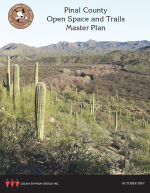
Pinal County Open Space and Trails Master Plan | Logan Simpson. 2007. Pinal County Open Space and Trails Master Plan. Tempe, Arizona: Logan Simpson Design Inc. October 31. Download PDF |
|
Scoping Report US 60 Superior to Globe: MP 222.6 to MP 258.0 | Logan Simpson. 2009. Scoping Report US 60 Superior to Globe: MP 222.6 to MP 258.0. Federal Aid No. STP-060-D(AAL). ADOT Project No. 060 GI 222 H7162 01L. Prepared for Arizona Department of Transportation. Tempe, Arizona: Logan Simpson Design Inc. December. Download PDF |
|
Pinal County Community Wildfire Protection Plan | Logan Simpson. 2018. Pinal County Community Wildfire Protection Plan. Tempe, Arizona: Logan Simpson. June. Download PDF |
|
Queen Creek TMDL Modeling Report | Louis Berger Group Inc. 2013. Queen Creek TMDL Modeling Report. Prepared for Arizona Department of Environmental Quality. Washington, DC: Louis Berger Group Inc. January. Download PDF |
|
Anthropogenic Degradation of the Southern California Desert Ecosystem and Prospects for Natural Recovery and Restoration | Lovich, J.E., and D. Bainbridge. 1999. Anthropogenic degradation of the Southern California desert ecosystem and prospects for natural recovery and restoration. Environmental Management 24(3):309-326. Download PDF |
|
Preliminary Integrated Geologic Map Databases for the United States | Ludington, S., B.C. Moring, R.J. Miller, P.A. Stone, A.A. Bookstrom, D.R. Bedford, J.G. Evans, G.A. Haxel, C.J. Nutt, K.S. Flyn, and M.J. Hopkins. 2007. Preliminary integrated geologic map databases for the United States. Western States: California, Nevada, Arizona, Washington, Oregon, Idaho, and Utah. Version 1.3. USGS Open-File Report (2005-1305). Available at: Preliminary integrated geologic map databases for the United States. Accessed January 5, 2019. Download PDF |

