Breadcrumb

  1. Home
  2. Documents
  3. Baseline Reports

Baseline Reports

The documents listed below represent baseline information collected by Resolution Copper and provided to the Tonto National Forest to be used as a partial basis for the analysis in the EIS. The Tonto National Forest will independently evaluate any data provided by Resolution Copper that is used in the EIS to ensure that it is valid, adequate to support the analysis, and represents the best available science.

Western Yellow-billed Cuckoo surveys were conducted in portions of Devils Canyon and Mineral Creek in the months of June through August 2011.

Resolution Copper Mining LLC (RCML) intends to implement a meteorological and air quality monitoring program to support several efforts during the pre-feasibility and other mine development phases.

This report summarizes meteorological measurements collected at the Resolution Copper Mine monitoring system. The purpose of the monitoring program is to provide the measurements necessary to establish existing meteorological conditions at the proposed site of the Resolution Mine in support of a future air quality permit application.

An evaluation of two areas, the West Plant and East Plant Analysis Areas, totaling approximately 3670 acres, for the presence of potential waters of the U.S.

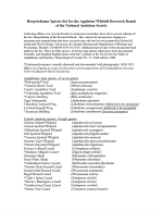
This list incorporates changes in taxonomy and nomenclature that have occurred since the last list was prepared. Additional species have been documented and added to the list.

This technical memorandum was prepared to summarize results of drilling, construction, equipping, and testing at hydrologic test wells DHRES-03, DHRES-04, and DHRES-05/DHRES-05B. The wells were installed to characterize hydrogeologic conditions in the Gila Conglomerate and Apache Leaf Tuff west of the Concentrator Fault in the vicinity of West Plant site and to provide monitoring locations for the aquifer west of the Concentrator Fault during dewatering operations in 2010 and 2011.

This technical memorandum was prepared to summarize results of drilling, construction, equipping, and testing at hydrologic test wells HRES-10 and HRES-11. The wells were installed to characterize hydrogeologic conditions in the Apache Leap Tuff (Tal) in the southeast extent of the Tal outcrop area near Mineral Creek. Monitoring data obtained from HRES-10 and HRES-11 will be incorporated into the RCM hydrologic monitoring program.

This technical memorandum was prepared to summarize results of drilling, construction, equipping, and testing at hydrologic test well DHRES-06. The well was installed to characterize hydrogeologic conditions in the deep groundwater system south of the South Boundary Fault and to provide a monitoring point for the deep groundwater system during dewatering of existing mine workings. Monitoring data obtained from DHRES-06 will be incorporated into the RCM hydrologic monitoring program.

This report summarizes meteorological measurements collected at the Resolution Copper Mine monitoring system. The purpose of the monitoring program is to provide the measurements necessary to establish existing meteorological conditions at the proposed site of the Resolution Mine in support of a future air quality permit application.

Identification of potentially jurisdictional waters within an approximately 45,000-acre analysis area, encompassing the Resolution operations and vicinity within Pinal and Gila Counties, Arizona.