Documents Cited - Draft EIS
|
Road Dust and its Environmental Impact on Alaskan Taiga and Tundra | Walker, D.A., and K.R. Everett. 1987. Road dust and its environmental impact on Alaskan taiga and tundra. Arctic and Alpine Research 19(4):479–489. Download PDF |
|
Queen Creek 2017 Aquatic Species and Habitat Surveys for Arizona Game and Fish Department - DRAFT | Warnecke, D., M. Dahlberg, S. Lashway, K. Smith, N. Robb, and A. Smith. 2018. Queen Creek 2017 Aquatic Species and Habitat Surveys for Arizona Game and Fish Department - DRAFT. Technical report. Phoenix: Arizona Game and Fish Department. December. Download PDF |
|
Arroyo 2018: Water and Irrigated Agriculture in Arizona | Water Resources Research Center. 2018. Arroyo 2018: Water and Irrigated Agriculture in Arizona. 2nd Edition. Revised. Dated June 27. Available at: Arroyo 2018. Accessed May 26, 2019. Download PDF |
|
Recovery of Severely Compacted Soils in the Mojave Desert, California, USA | Webb, R.H. 2002. Recovery of severely compacted soils in the Mojave Desert, California, USA. Arid Land Research and Management 16(3):291-305. Download PDF |
|
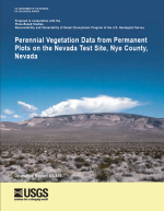
Perennial Vegetation Data from Permanent Plots on the Nevada Test Site, Nye County, Nevada | Webb, R.H., M.B. Murov, T.C. Esque, D.E. Boyer, L.A. DeFalco, D.F. Haines, D. Oldershaw, S.J. Scoles, K.A. Thomas, J.B. Blainey, and P.A. Medica. 2003. Perennial Vegetation Data from Permanent Plots on the Nevada Test Site, Nye County, Nevada. Open-File Report 03-336. Tucson, Arizona: U.S. Geological Survey. Download PDF |
|
The Response of Vegetation to Disturbance in Death Valley National Monument, California | Webb, R.H., J.W. Steiger, and E.B. Newman. 1988. The Response of Vegetation to Disturbance in Death Valley National Monument, California. U.S. Geological Survey Bulletin 1793. Washington D.C.: U.S. Geological Survey. Download PDF |
|
Dynamics of Mojave Desert Shrub Assemblages in the Panamint Mountains, California | Webb, R.H., J.W. Steiger, and R.M. Turner. 1987. Dynamics of Mojave Desert shrub assemblages in the Panamint Mountains, California. Ecology 68(3):478-490. Download PDF |

|
Characteristic Patterns of Chronic and Dynamic Photoinhibition of Different Functional Groups in a Mediterranean Ecosystem | Werner, C., O. Correia, and W. Beyschlag. 2002. Characteristic patterns of chronic and dynamic photoinhibition of different functional groups in a Mediterranean ecosystem. Functional Plant Biology 29:999–1011. Download PDF |
|
Climate of Arizona | Western Regional Climate Center. 2018. Climate of Arizona. Available at: Climate of Arizona. Accessed September 20, 2018. |
|
Ecological Overview: San Pedro River Parcel, Pinal County, Arizona | WestLand Resources. 2003. Ecological Overview: San Pedro River Parcel, Pinal County, Arizona. Job No. 807.03 SP 340. Prepared for Resolution Copper. Tucson, Arizona: WestLand Resources Inc. September 10. Download PDF |
|
Ecological Overview: 6L Ranch Parcel, Yavapai County, Arizona | WestLand Resources. 2004a. Ecological Overview: 6L Ranch Parcel, Yavapai County, Arizona. Job No. 807.06 6L 300. Prepared for Resolution Copper. Tucson, Arizona: WestLand Resources Inc. July 19. Download PDF |
|
Ecological Overview: Appleton Ranch Parcel, Santa Cruz County, Arizona | WestLand Resources. 2004b. Ecological Overview: Appleton Ranch Parcel, Santa Cruz County, Arizona. Job No. 807.06 RR 300. Prepared for Resolution Copper. Tucson, Arizona: WestLand Resources Inc. May 26. Download PDF |
|
Ecological Overview: JX Ranch Parcel, Gila County, Arizona | WestLand Resources. 2004c. Ecological Overview: JX Ranch Parcel, Gila County, Arizona. Job No. 807.06 JX 300. Prepared for Resolution Copper. Tucson, Arizona: WestLand Resources Inc. March 31. Download PDF |
|
Ecological Overview: LX Bar Ranch Parcel, Yavapai County Arizona | Westland Resources. 2004d. Ecological Overview: LX Bar Ranch Parcel, Yavapai County Arizona. Job No. 807.06 TC 300. Prepared for Resolution Copper. Tucson, Arizona: WestLand Resources Inc. March 3. Download PDF |
|
A Class III Cultural Resources Survey of Approximately 0.45 Acre Near Superior, Arizona | WestLand Resources. 2009. A Class III Cultural Resources Survey of Approximately 0.45 Acre Near Superior, Arizona. Project No.: 807.15 110-1. Tucson, Arizona: WestLand Resources, Inc. September 18. Download PDF |
|
Phase I Site Assessment Non-Federal Parcel - Dripping Springs | WestLand Resources. 2015a. Phase I Environmental Site Assessment: Non-Federal Parcel - Dripping Springs, Gila County, Arizona. Project No. 807.98. Prepared for Resolution Copper. Tucson, Arizona: WestLand Resources Inc. June 24. Download PDF |
|
Phase I Environmental Site Assessment Apache Leap South End | WestLand Resources. 2015b. Phase I Environmental Site Assessment: Non-Federal Parcel, Apache Leap South End, Gila County, Arizona. Project No. 807.98. Prepared for Resolution Copper. Tucson, Arizona: WestLand Resources Inc. August 13. Download PDF |
|
Ecological Overview: Dripping Springs Parcel, Gila and Pinal Counties, Arizona | WestLand Resources. 2016a. Ecological Overview, Dripping Springs Parcel, Gila and Pinal Counties, Arizona: Resolution Copper. Project Number: 807.98 13 06. Prepared for Resolution Copper. Tucson, Arizona: WestLand Resources Inc. December. Download PDF |
|
Phase I Environmental Site Assessment Non-Federal Parcel, East Clear Creek, Coconino County, Arizona | WestLand Resources. 2016b. Phase I Environmental Assessment, Non-Federal Parcel, East Clear Creek, Coconino County, Arizona: Resolution Copper. Project Number: 807.126. Prepared for Resolution Copper. Tucson, Arizona: WestLand Resources Inc. September. Download PDF |
|
Phase I Environmental Site Assessment Non-Federal Parcel, Tangle Creek (LX Bar Ranch), Yavapai County, Arizona | WestLand Resources. 2016c. Phase I Environmental Assessment, Non-Federal Parcel, Tangle Creek (LX Bar Ranch), Yavapai County, Arizona: Resolution Copper. Project Number: 807.119. Prepared for Resolution Copper. Tucson, Arizona: WestLand Resources Inc. October. Download PDF |
|
Phase I Environmental Site Assessment Non-Federal Parcel, Appleton Ranch, Santa Cruz County, Arizona | WestLand Resources. 2016d. Phase I Environmental Site Assessment, Non-Federal Parcel, Appleton Ranch, Santa Cruz County, Arizona: Resolution Copper. Project No. 807.121. Prepared for Resolution Copper. Tucson, Arizona: WestLand Resources Inc. September. Download PDF |

|
Phase I Environmental Site Assessment Non-Federal Parcel, Cave Creek (6L Ranch), Maricopa County, Arizona | WestLand Resources. 2016e. Phase I Environmental Site Assessment, Non-Federal Parcel, Cave Creek (6L Ranch), Maricopa County, Arizona: Resolution Copper. Project No. 807.120. Prepared for Resolution Copper. Tucson, Arizona: WestLand Resources Inc. September. Download PDF |
|
Phase I Environmental Site Assessment Non-Federal Parcel, Turkey Creek (JX Bar Ranch), Gila County, Arizona | WestLand Resources. 2016f. Phase I Environmental Site Assessment, Non-Federal Parcel, Turkey Creek (JX Bar Ranch), Gila County, Arizona: Resolution Copper. Project Number: 807.118. Prepared for Resolution Copper. Tucson, Arizona: WestLand Resources Inc. October. Download PDF |
|
2017 Forest Sensitive Plant Species Survey Within the Resolution Copper Project Area | WestLand Resources. 2017a. 2017 Forest Sensitive Plant Species Survey Within the Resolution Copper Project Area. Project Number: 807.132 06. Tucson, Arizona: WestLand Resources Inc. November. Download PDF |

|
Ecological Overview East Clear Creek Parcel | WestLand Resources. 2017b. Ecological Overview, East Clear Creek Parcel, Coconino County, Arizona: Resolution Copper. Project Number: 807.98 13 06. Prepared for Resolution Copper. Tucson, Arizona: WestLand Resources Inc. January 24. Download PDF |
|
General Plan of Operations and Legislative Land Exchange Screening Analysis for Special Status Species | WestLand Resources. 2017c. General Plan of Operations and Legislative Land Exchange Screening Analysis for Special Status Species: Resolution Copper. Project Number: 807. 115 05-8985 04. Prepared for Tonto National Forest. Tucson, Arizona: WestLand Resources Inc. December. Download PDF |
|
Phase I Environmental Site Assessment, Non-Federal Parcel, Lower San Pedro River, Pinal County, Arizona | WestLand Resources. 2017d. Phase I Environmental Site Assessment, Non-Federal Parcel, Lower San Pedro River, Pinal County, Arizona: Resolution Copper. Project Number: 807.134. Prepared for Resolution Copper. Tucson, Arizona: WestLand Resources Inc. November. Download PDF |
|
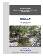
2017 Fish Survey for the Resolution Copper Project | WestLand Resources. 2018a. 2017 Fish Survey for the Resolution Copper Project. Project Number: 807.132 04 04. Prepared for Resolution Copper. Tucson, Arizona: WestLand Resources Inc. March 9. Download PDF |
|
Resolution Copper Water Balance Tailings Alternatives 2, 3, 4, 5, and 6 | WestLand Resources. 2018b. Resolution Copper Water Balance Tailings Alternatives 2, 3, 4, 5, and 6. Project No.: 807.141 02. Prepared for Resolution Copper. Tucson, Arizona: WestLand Resources Inc. September 4. Download PDF |
|
Resolution Tailings Storage Facility Alternatives: Comparative Analysis of Ordinary High Water Mark, Aquatic Features, and Potential Waters of the U.S. | WestLand Resources. 2018c. Resolution Tailings Storage Facility Alternatives: Comparative Analysis of Ordinary High Water Mark, Aquatic Features, and Potential Waters of the U.S. Project No.: 0807.149 06. Tucson, Arizona: WestLand Resources Inc. September 6. Download PDF |
|
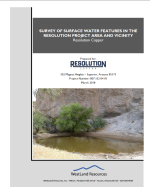
Survey of Surface Water Features in the Resolution Project Area and Vicinity | WestLand Resources. 2018d. Survey of Surface Water Features in the Resolution Project Area and Vicinity: Resolution Copper. Project Number: 807.132 04 01. Prepared for Resolution Copper. Tucson, Arizona: WestLand Resources Inc. March. Download PDF |
|
DRAFT - Resolution Copper Project Clean Water Act, Section 404, Conceptual Mitigation Plan | WestLand Resources. 2019. DRAFT - Resolution Copper Project Clean Water Act, Section 404, Conceptual Mitigation Plan. Project No.: 807.149 10. Tucson, Arizona: WestLand Resources Inc. May 16. Download PDF |
|
Spring and Seep Catalog | WestLand Resources, and Montgomery and Associates. 2018. Spring and Seep Catalog, Resolution Copper Project Area, Upper Queen Creek and Devils Canyon Watersheds. Prepared for Resolution Copper. Version 2.0. Tucson, Arizona: WestLand Resources Inc. and Montgomery and Associates. June 15. Download PDF |
|
Arizona Department of Transportation Guidelines for Highways on Bureau of Land Management and U.S. Forest Service Lands | Wheat Scharf Associates and ADOT/FHWA/BLM/USFS Steering Committee. 2008. Arizona Department of Transportation Guidelines for Highways on Bureau of Land Management and U.S. Forest Service Lands. Prepared for Arizona Department of Transportation, Federal Highway Administration, Bureau of Land Management, and U.S. Forest Service. Tucson, Arizona: Wheat Scharf Associates. Download PDF |
|
Invasive Plants and Weeds of the National Forests and Grasslands in the Southwestern Region | White, M.R. (ed.). 2013. Invasive Plants and Weeds of the National Forests and Grasslands in the Southwestern Region. MR-R3-16-6. Albuquerque, New Mexico: U.S. Forest Service, Southwestern Region. December. Download PDF |
|
Prediction of Tailings Seepage Water Chemistry Influenced by Tailings Weathering Processes | Wickham, M. 2018. Prediction of tailings seepage water chemistry influenced by tailings weathering processes. Technical memorandum. South Jordan, Utah: Rio Tinto. August 23. Download PDF |

|
Avian Surveys Conducted by Audubon Arizona IBA Program at 7B Ranch, Lower San Pedro River, Mammoth, Arizona, 2006-2010 | Wilbor, S. 2010. Avian surveys conducted by Audubon Arizona IBA Program at 7B Ranch, Lower San Pedro River, Mammoth, Arizona, 2006-2010. Tucson Audubon Society. Download PDF |
|
Co-development of Biological Soil Crusts, Soil-geomorphology, and Landscape Biogeochemistry in the Mojave Desert, Nevada, U.S.A. - Implications for Ecological Management | Williams, A.J. 2011. Co-development of biological soil crusts, soil-geomorphology, and landscape biogeochemistry in the Mojave Desert, Nevada, U.S.A. - Implications for ecological management. Ph.D. dissertation, Department of Geoscience, University of Nevada, Las Vegas. Download PDF |
|
Biological Soil Crusts in the Mojave Desert, USA: Micromorphology and Pedogenesis | Williams, A.J., B.J. Buck, and M.A. Beyene. 2012. Biological soil crusts in the Mojave Desert, USA: Micromorphology and pedogenesis. Soil Science Society of America Journal 76(5):1685-1695. Download PDF |
|
Geomorphic Controls on Biological Soil Crust Distribution: A Conceptual Model from the Mojave Desert (USA) | Williams, A.J., B.J. Buck, D.A. Soukup, and D.J. Merkler. 2013. Geomorphic controls on biological soil crust distribution: A conceptual model from the Mojave Desert (USA). Geomorphology 195(2013):99-109. Download PDF |
|
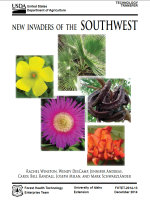
New Invaders of the Southwest | Winston, R., W. DesCamp, J. Andreas, C.B. Randall, J. Milan, and M. Schwarzländer. 2014. New Invaders of the Southwest. FHTET-2014-13. Moscow, Idaho: University of Idaho Extension; Forest Health Technology Enterprise Team. December. Download PDF |
|
Evidence for Edge Effects on Multiple Levels in Tallgrass Prairie | Winter, M., D.H. Johnson, and J. Faaborg. 2000. Evidence for edge effects on multiple levels in tallgrass prairie. The Condor 102:256-266. Download PDF |
|
Tailings Management Facilities - Risks and Reliability | Witt, J.K., M. Schönhardt, J. Saarela, R. Frilander, J. Csicsak, M. Csővari, A. Várhegyi, D.P. Georgescu, C.A. Radulescu, M. Zlagnean, J. Bõhm, Á. Debreczeni, I. Gombkötõ, A. Xenidis, E. Koffa, A. Kourtis, and J. Engels. 2004. Tailings Management Facilities - Risks and Reliability. Edited by J.K. Witt and M. Schönhardt. Contract Number: EVG1-CT-2002-00066. Report of the European RTD project TAILSAFE. Weimar, Germany: Bauhaus-University of Weimar; TAILSAFE. September. Download PDF |

|
Site-Specific Seismic Hazard Analyses for the Resolution Mining Company Tailings Storage Facilities Options, Southern Arizona | Wong, I., E. Nemser, M. Dober, S. Olig, J. Bott, F. Terra, R. Darragh, and W. Silva. 2013. Site-Specific Seismic Hazard Analyses for the Resolution Mining Company Tailings Storage Facilities Options, Southern Arizona. Prepared for Resolution Copper. Oakland, California: URS Corporation; El Cerrito, California: Pacific Engineering and Analysis. June 3. Download PDF |
|
Site-Specific Seismic Hazard Evaluation for the Proposed Resolution Copper Mine, Southern Arizona | Wong, I., P. Thomas, N. Lewandowski, and S. Lindvall. 2018. Site-Specific Seismic Hazard Evaluation for the Proposed Resolution Copper Mine, Southern Arizona. Prepared for Resolution Copper. Walnut Creek, California: Lettis Consultants International Inc. January 23. Download PDF |
|
Updated Site-Specific Seismic Hazard and Development of Time Histories for Resolution Copper's Near West Site, Southern Arizona | Wong, I., P. Thomas, N. Lewandowski, S. Lindvall, and A. Seifried. 2017. Updated Site-Specific Seismic Hazard and Development of Time Histories for Resolution Copper's Near West Site, Southern Arizona. Prepared for Resolution Copper. Walnut Creek, California: Lettis Consultants International Inc. November 27. Download PDF |
|
Site-Specific Probabilistic and Deterministic Seismic Hazard Analyses for Sierrita Tailing Dam, Green Valley, Arizona | Wong, I., P. Thomas, S. Olig, and F. Terra. 2008. Site-Specific Probabilistic and Deterministic Seismic Hazard Analyses: Sierrita Tailing Dam Green Valley, Arizona. Prepared for Phelps Dodge Sierrita Inc. Oakland, California: URS Corporation. October 31. Download PDF |
|
Tectonic Stresses in Mine Seismicity: Are They Significant? | Wong, I.G. 1993. Tectonic stresses in mine seismicity: Are they significant? Paper presented at the Rockbursts and Seismicity in Mines 93. Proceedings of the Third International Symposium, Kingston, Canada. Download PDF |
|
Empirical Investigation and Characterization of Surface Subsidence Related to Block Cave Mining | Woo, K.-S., E. Eberhardt, D. Elmo, and D. Stead. 2013. Empirical investigation and characterization of surface subsidence related to block cave mining. International Journal of Rock Mechanics and Mining Sciences 61(2013):31-42. Download PDF |
|
Surface Control of Desert Pavement Pedologic Process and Landscape Function, Cima Volcanic Field, Mojave Desert, California | Wood, Y.A., R.C. Graham, and S.G. Wells. 2005. Surface control of desert pavement pedologic process and landscape function, Cima Volcanic field, Mojave Desert, California. Catena 59(2005):205-230. Download PDF |
|
Perched Water in Fractured, Welded Tuff: Mechanisms of Formation and Characteristics of Recharge | Woodhouse, G.E. 1997. Perched Water in Fractured, Welded Tuff: Mechanisms of Formation and Characteristics of Recharge. Unpublished Ph.D. dissertation, Department of Hydrology and Water Resources, University of Arizona. Download PDF |
|
Some Effects of Fire on Shrubs and Succulents in a Chihuahuan Desert Community in the Franklin Mountains, El Paso County, Texas | Worthington, R.D., and R.D. Corral. 1987. Some effects of fire on shrubs and succulents in a Chihuahuan Desert community in the Franklin Mountains, El Paso County, Texas. Paper presented at the Second Symposium on Resources of the Chihuahuan Desert Region, United States and Mexico, Alpine, Texas. Download PDF |
|
Resolution Copper Groundwater Flow Model Report | WSP USA. 2019. Resolution Copper Groundwater Flow Model Report. Project No.: 31400968. Greenwood Village, Colorado: WSP USA. February 15. Download PDF |

